
What’s a historic place?
The Victorian Environment Assessment Council is conducting an ‘Historic Places Investigation’, submissions for which are due to VEAC by September 12.
FOBIF is making a submission to this process, arguing that a historic place is not simply something old you can look at and have thoughts about the past. It’s a place in which you can see change happening, as the practices of the past are changed to suit new community needs.
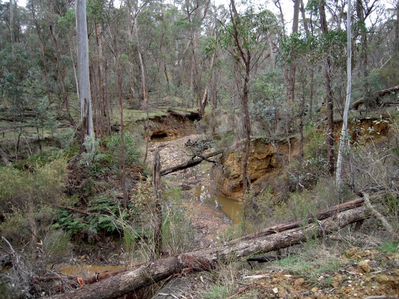
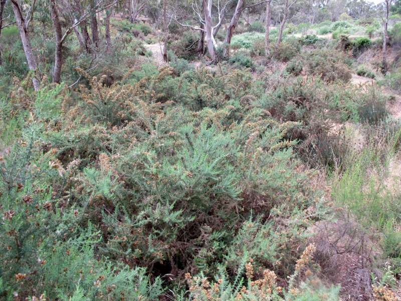
Sebastopol Creek, in the Castlemaine Diggings NHP: ruined waterways on the slow path to recovery are a dramatic historic reality.
Specifically, we are arguing that the Castlemaine Diggings National Heritage Park should be valued not simply for its evidence of gold workings, but more especially for the way it shows the spectacular environmental damage wrought in the past, and the way this damage is gradually being repaired over time.
FOBIF’s submission runs as follows:
“We wish to make a submission to this enquiry, focusing on the Castlemaine Diggings National Heritage Park as a Historic Landscape.
“The Diggings Park was given National Heritage status in 2005. The declaration statement goes into great detail about evidence of mining practices in this landscape. This is fully justified. What is less understandable is that the statement completely overlooked what is perhaps the most striking single feature of this landscape: that is, the ruined waterways. The environmental devastation wrought by gold fever is mentioned blandly in one sentence: ‘The degree of alteration of, and intervention in, the natural landscape makes a strong impression on visitors.’
![Bullant [genus Myrmecia] exploring a DSE 'control burn' in the Diggings Park, 2010: ants are not only intriguing, they're good for the soil. Photo: John Ellis](https://www.fobif.org.au/admin/wp-content/uploads/2014/07/Ant-1-2-800x600.jpg)


 Click on image for info/order page
 Click on image for info/order page
 Click on image for info/order page

")


")


