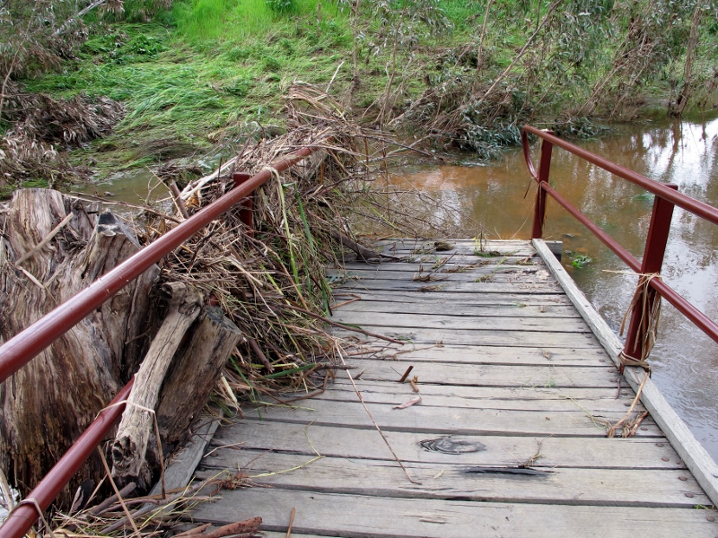
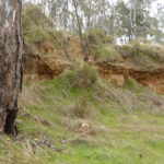
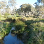
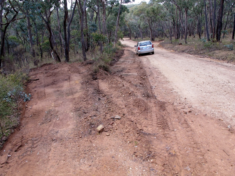
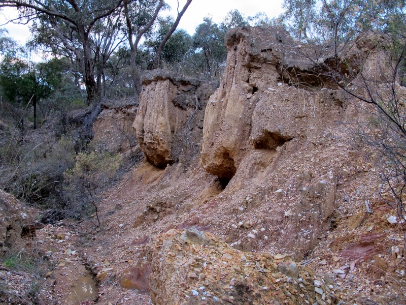
The past: what’s important? what’s not?

Want to have a say on the way heritage is presented in the Diggings Park? Have a go at doing the Parks Victoria survey. It only takes a few minutes, and your answers might tilt the balance of the way the park is presented.  You have until midnight this coming Wednesday November 30 to do it.

The questions are mainly straightforward—perhaps the crunch question is number 13: ‘Information signage in Castlemaine Diggings National Heritage Park currently focuses on its important mining heritage. Are there other themes, stories or aspects of the park that should also be told?’

As we’ve said before, one of the problems with the presentation of goldfields heritage is that it doesn’t give due weight to the environmental impact of mining. For that reason, perhaps a good response to question 13 might be something like this:

The problem is not that the focus is on mining heritage: the problem is that this heritage is presented with virtually no emphasis on the destructive effects of mining, even though these are staring us in the face in the form of the total destruction of almost all the waterways in the park: these eroded gullies, and hillsides stripped of soil, are also ‘heritage’.

…But it’s your say: have a go!

Posted in News | Comments Off on The past: what’s important? what’s not?

Fire stop press: A ‘mapping error’!

FOBIF has received a note from DELWP confirming receipt of our fire submission (see post below). They advise us that the rezoning of Expedition Pass as an Asset Protection zone was a ‘mapping error”.

The area has now been restored to its previous status as a Landscape Management zone.

We’re a bit at a loss for words. We’ll comment in more detail on this and related matters after we meet with fire managers in December.

Extract of letter to FOBIF from West Central Risk Landscape Team:

As a result of your comments, the zoning at Expedition Pass reservoir near Castlemaine has been reinstated as Landscape Management Zone.  While the change was a mapping error, we acknowledge and apologise for the concerns this has caused within your organisation.

Please find attached updated maps of the proposed fire management zones in the Castlemaine – Maldon area.

North Castlemaine, updated map 17 November 2017
Castlemaine, updated map 17 November 2017
Maldon, updated map 17 November 2017

Posted in News | Comments Off on Fire stop press: A ‘mapping error’!

Fire submission

FOBIF has made a submission to the latest round of fire consultations [see our November 3 Post]. Essentially the submission criticises the zonings around Expedition Pass and the Loddon River, questions the size of some of the zones, and raises [again] the neglect of systematic fuel management on private land. FOBIF representatives will meet with DELWP early in December to discuss these concerns.

The substance of the submission is set out below [zone references can be understood by reference to the map at this link]:

***

Thank you for the opportunity to comment on the fire management review.

We have three general and four specific comments:

General

  1. We continue to be concerned by the apparent inability of DELWP to integrate private land fuel management into its risk program, despite the large ‘priority fuel management areas’ on private land in the West Central Risk landscape maps. The result of this inability is the artificial isolation of public land and an over emphasis on it, despite the fact that in our area the overwhelming majority of fires start on private land. We also have the occasionally bizarre example of small parcels of public land singled out for burning, although they are surrounded by much larger areas of apparently more dangerous private land. CAS 2 is a bizarre example, and CAS 11 an example where DELWP seems to have admitted the impracticality of dealing with public land in isolation.

Continue reading

Posted in News | Comments Off on Fire submission

FOBIF has been nominated for a Kookaburra Award

kookaburra-award-image

Parks Victoria Kookaburra Awards – Acknowledging outstanding voluntary contributions to the Parks Victoria estate

FOBIF is proud to have been nominated for a Parks Victoria 2016 Connecting People to Parks Kookaburra Award.

Parks Victoria presents the Kookaburra Awards to individuals and Friends groups that have made an outstanding contribution to the Parks Victoria estate.

The Northern Region awards will be presented at a Kookaburra Awards Ceremony to be held at Maldon Vintage Machinery Museum, Vincents Street, Maldon on Saturday 3 December 2016, from 10.30 to 2.30pm.

 If you would like to attend this event  as a FOBIF representative please email us at info@fobif.org.au by Monday 21 November.

Posted in News | Comments Off on FOBIF has been nominated for a Kookaburra Award

Here’s news: speed doesn’t kill

Vicroads has circulated a letter to those interested in its proposed Pyrenees Highway works. Readers will remember that a number of trees were slated for removal in this project. FOBIF has accepted that some trees need removal, but not as many as proposed. We have argued that a better safety result could be achieved if–among other measures– the speed limit was reduced between Newstead and Green Gully.

Vicroads response to this is clear from its letter:

‘A reduction of the speed zone would
 not lead to a decrease in the amount
 of barrier treatments used in this instance. The impact of an errant vehicle with 
a roadside hazard (tree, power pole) at 
80 kmh can still lead to a serious injury
 or fatality.

‘The Installation of safety barriers provides the safest option.’

The implication of the letter is clear: that Vicroads will essentially proceed with its original proposal. It seems, from the above paragraph, that the purpose of the project is not so much to reduce the number of ‘run off road’ accidents as to soften the effect of the ones that do happen. A more effective approach would aim at both—and if it resulted in less environmental damage, all the better.

Vicroads seems to have set aside the reasoning behind TAC ‘wipe off five’ campaigns: ‘Eight Wipe off 5 campaigns have been released with all emphasising even a small reduction in speed can make the difference between life and death.’ This widely accepted argument is particularly strong on a winding, narrow stretch of Highway like the one between Green Gully and Newstead.

Vicroads has supported some offset planting, and other ‘palliative’ measures. Nevertheless, we believe its position here is consistent with its activities on the Western Highway, and the Calder at Ravenswood: a narrow understanding of efficiency and safety sweeps aside other values.

Posted in News | Comments Off on Here’s news: speed doesn’t kill

Photos coming in for our FOBIF show

Several photos for our 2017 exhibition, Mountains and Waterways, have been added to our new Flickr album during the last week. Noel Muller, Ranger Team Leader Goldfields, Parks Victoria, has sent a quirky tree photo from Mount Tarrengower and several FOBIF members have been visiting our flooded swamps. It’s a good time to get out and take water related photos after our recent rains. If you would like directions on how to get to swamps and other sites let us know at info@fobif.org.au

web-mountains-revised-noel-img_1629-medium

Mount Tarrengower, 15 October 2016

web-walkers_mg_4524

Walkers Swamp, 14 November 2016

web-bells-swamp-9-11-16-2-800x600

Bells Swamp, 9 November 2016

Posted in News | Comments Off on Photos coming in for our FOBIF show

Not news on the highway

Snakes are out and about, though they’ve become active a little later this year because of cooler conditions.

Obviously people should be careful in areas where snakes are likely to be present–and not only for their own safety.

The picture below is a dismal reminder of the annual massacre on our highways. As we’ve reported before, the kill rate on the roads is both frightful, and very often avoidable: and reptiles are special victims.

Another reason for slowing down…

Pyrenees Highway, McKenzie Hill, November 9:

Pyrenees Highway, McKenzie Hill, November 9:  a sight so common as to be almost unnoticeable.

And on a more positive note: below is a photo of a turtle [any suggestions on the species? We think it might be a Common Long Neck–Chelodina longicollis] found by a driver in the middle of a dirt road in Walmer, and safely removed to the side of the road:

web-_mg_4514

Posted in News | Comments Off on Not news on the highway

What are our state forests for?

The answer to this question might seem obvious—they’re a resource for timber, right?

But for many years forestry officials have also claimed that these forests are valuable, and greatly valued, for their biodiversity and their recreational uses.

The idea has charm, but it’s fair to say that in much of our forest estate both biodiversity and recreation have consistently suffered in the pursuit of the resource. And there’s even a bit of confusion in the community as to what terms like ‘state forest’, ‘state park’ and so on actually mean.

Now the Victorian Environmental Assessment Council is going to conduct two reviews into State Forests outside our immediate region, but of great interest for the relevance they might have for our own state forests.

The first is focused on conservation values in the forest estate east of the Hume Highway, and the second concentrates on three forest areas in the Central West: Wellsford SF [north of Bendigo], Wombat SF to the south, and Mount Cole and the Pyrenees to the west of us.

Continue reading

Posted in News | Comments Off on What are our state forests for?

Call for photos!

The theme of the next FOBIF photo exhibition is Mountains and Waterways.

TOGS Cafe in Castlemaine will host the exhibition in November 2017.

So if you have a favourite photo/s of

  • Mount Alexander, Mount Tarrengower or other mountain in Mount Alexander region (you can include photos of the mountains and flora and fauna on the mountains) and/or
  • Waterways such as creeks, rivers, dams, Expedition Pass, Bells Swamp, Cairn Curran (photos of the Moolort Swamps can also be included)

send them along to FOBIF (info@fobif.org.au). There is also plenty of time to take new photos: the closing date for the submission of photos is not till 1 October 2017. We are telling people well in advance of the exhibition as this years heavy winter and spring rains means now is a perfect time now to take waterways photos.

We will place all photos we receive in a designated album on the FOBIF Flickr site as long as they fall within the guidelines. A FOBIF sub-committee will then select approximately 18 photos to be printed and framed for the exhibition.

If your photo is selected, as well as being included in the exhibition, you will receive a free framed copy of your photo.

Guidelines

  1. Photo to include Mountains or Waterways within the Mount Alexander region and including Moolort Plains.
  2. A small file size is fine for Flickr but the photo will need to be at least 3 mg to be printed and included in the exhibitions. (At this stage only send files under 1mg).
  3. Include the photo’s location, date, plus identification of flora and fauna.
  4. Photos can be closeups, landscapes as well as photos where flora and fauna associated with mountains and waterways are the main feature.

We have already set up the Mountains and Waterways album so you can get an idea of the range of photos that fall within the guidelines. See also photos on this post

Contact Bronwyn Silver at info@fobif.org.au or 54751089 for further information.

Posted in Nature Observations, News | Comments Off on Call for photos!

Let’s burn the Res! And while we’re about it, let’s burn the Loddon!

Fire management zones in our area have been revised to accommodate the new ‘risk’ system which has replaced the unlamented five per cent target.

The  new zones–which are up for public comment– can be seen the map at the end of this post. For a map which can be expanded, go to this link . Click on the zoom to get detail.

Fancy a swim in the ash? It's proposed to burn this bush severely at regular intervals.

Fancy a swim in the ash? It’s proposed to burn this bush–and all around the Expedition Pass reservoir–severely, and at regular intervals.

Matters of serious concern to FOBIF are

–a Zone 1 area now completely surrounds Expedition Pass reservoir and Dunstans Flat:  this means the area around the Res will be severely burned as often as every five  years.

–The Loddon River Valley around Vaughan is Zoned 2, with a narrow Zone 1 strip.

The Expedition Pass reservoir and surrounds, apart from being an important amenity for locals, contains some of the oldest Stringybarks in the region, the best collection of White Box in the region, and some very old Grey and Red Box trees.

Remnant Red Stringybark towers above surrounding regrowth bush north of Expedition Pass reservoir. The upper slopes of this hill are rich in older trees.

Remnant Red Stringybark towers above surrounding regrowth bush north of Expedition Pass reservoir. The upper slopes of this hill are rich in older trees.

Justification for the proposal [coded CAS 02] is given as ‘for the protection of Faraday from fires spreading from south west of the community’. At this stage, we’re completely unable to see the logic in this: it looks to us as if someone in an office has done a desk top modelling exercise without any knowledge of the area and its value. We’ll quiz fire officers about the detail of this proposal. We’ll also be asking what fuel reduction, if any, is proposed for private land in the area: according to the original West Central documents, private land throughout Faraday and Sutton Grange is a ‘priority fuel management area’…but not enough of a priority to actually do anything, it seems.

And what about the Loddon?

For some months West Central maps have shown an extensive area along the Loddon near Vaughan as zoned 2 ‘bushfire moderation’, that is, up for regular burning.  We were assured by fire officers a few months ago that this ‘would not happen’, because DELWP policy was not to burn areas of River Red Gum, the dominant tree in this valley. We’re now wondering what such assurances are worth.

Of course, the zoning system applies only to public land. As we’ve noted above, the much proclaimed ‘tenure blind’ system of looking at landscapes for fire protection purposes seems to be as dormant as ever: so public land cops the brunt of fuel reduction exercises, and private land—at least as dangerous—is left alone, as too hard to handle, or left to erratic or inconsistent local rules.

More details on the risk landscape approach can be found here, together with info on how to put in a submission.

FOBIF will be making a submission to this consultation before the closing date of November 25. We urge others to do the same: even asking a question has a use. Send comments or questions to west.central@delwp.vic.gov.au

west-central-fire-management-zone-review-2016

This link is DELWP’s feedback form: pdf 2.

This link offers a brief justification of the Phoenix Rapidfire modelling system: pdf 1

Posted in Fire Management, News | 1 Comment