Signs of the ancient and dynamic Earth

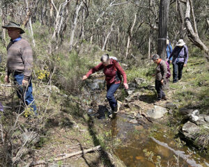
Photo1: The once horizontal sandstone layers are now almost vertical – folded and tilted by shifting tectonic plates.

The mysterious sandstone layers of Castlemaine and Chewton are one of the most defining characteristics of the local bush. Like the bones of some ancient earthly animal, they form a pattern of upstanding ribs that hold clues to the land’s long evolution. Under a microscope, the sandstone is made up of untold billions of sand grains, and many have the distinctive features of grains derived from a granitic terrain – most probably the ancient Gondwanan mountains that rose to our west some 480 million years ago. The mountains were weathered down and rivers carried grain after grain to the ocean floor further east, showing us recycling is nothing new!

Having survived that little trauma, the grains remained happily undisturbed for 40 million years in their ocean floor beds. Then suddenly they were subjected to the relentless forces of plate tectonics. All the layers were squashed between the ancient Gondwana continent margin and the palaeo-Pacific tectonic plate to the east. These forces just happened to be east-west and so all the folded layers now run north-south forming a handy visual compass for our ramblings in the bush.

The sandstones of the bush might look ancient and immovable but they remind us of our dynamic Earth and the constant recycling of, well, everything!

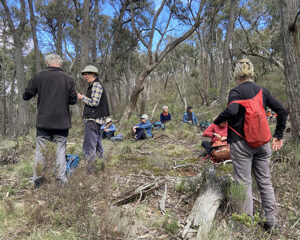
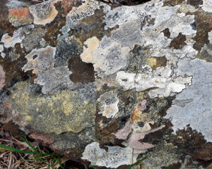
Photo 2: The sandstone is stained by iron-bearing minerals and is cut by cracks, called joints

This is the eighth post in our geology series written by Clive Willman. 

Posted in Geology | 1 Comment

Here’s an answer–Oh…but what was the question?

FOBIF has received an answer from Forest Fire Management to its submission on current plans for management burns in this area.

We print the answer in full below. You can check to see if it answers any of the questions in our submission.We don’t believe it does.

This kind of exchange, or non-exchange, is an example of one of the problems of ‘consultation’: questions are asked, answers are given…but there doesn’t seem to be any connection between the two.

Part of the problem is that we, and other concerned groups, keep asking questions about specific places: and we want specific answers to these questions. Either the Department doesn’t have the answers, or the officers don’t actually have the time to pay attention to each submission. The result casts doubt on the value of the ‘consultation’ process.

Looking north from the Wewak Track, August 2022: the dark green is carpets of Matted Bush-pea. Is it a high fire risk? The area is slated for ‘fuel reduction’, but it seems impossible to get details through the consultation process as to how the burn will be managed.

Readers can judge for themselves. Here’s the DELWP response to our submission:

‘Thank you for your letter explaining your concerns regarding fuel reduction burns listed on the Loddon Mallee Joint Fuel Management Program (JFMP) 2022/23-2024/25.

‘Strategic Fuel Breaks (SFB) work together with our zoning by establishing areas of reduced fuel that support planned burn operations to be conducted adjacently. The SFB program has been developed in conjunction with our planned burning program.

‘We carry out a range of on-ground preparation works before the burn to ensure that the planned area is safe to ignite when the conditions are right. Planned burn preparation is essential for the safety of fire crews and the community. Preparation works may include raking around trees to protect habitat trees, removing hazardous trees to make the burn safer for fire crews, grading the existing roads and tracks to improve access and reduce the risk of the burn escaping. We’ll adjust ignition and monitor fire behaviour to meet appropriate burn objectives, which is supported by the advancements in weather forecast products, burn prescriptions and smoke modelling.

‘Forest Fire Management Victoria (FFMV) continues to collect fuel hazard data pre and post burn for a selection of our high priority burns in the Asset Protection (APZ) and Bushfire Moderation (BMZ) Fire Management Zones, covering at least 20 per cent of burns. We collect this information as part of our tracking of progress toward strategy implementation and into inform our understanding of fuel recovery rates. For example, we have also used this fuel hazard data, collected over many years in Box-Ironbark forests, to update our fuel models used for decision making.

‘As part of the Victorian Bushfire Monitoring Program, FFMV is working to improve our specific understanding of fire effects on the environment – this includes both planned burning and bushfire. In the Box-Ironbark forests, there is a statewide project that the Department of Environment, Land, Water and Planning has contracted the University of Melbourne to undertake through the Bushfire Hazards Cooperative Research Centre. This work commenced early in 2021.

‘We look forward to future constructive collaborations with the Castlemaine community and encourage you to continue to share data and your concerns with us as we endeavour to find the balance between protection of communities and the environment from bushfire.

Yours sincerely’

Posted in Fire Management | 2 Comments

Reminder about FOBIF AGM on 12 September

As outlined in a previous post, the FOBIF AGM will be held in the Ray Bradfield Room on 12 September beginning at 7.30. After a short time for AGM formalities Patrick Kavanagh will deliver on talk on Photographing Nature. Patrick has contributed to all of our FOBIF photography shows. He describes his interest in photograph in the following words:

I live in the woodlands of Central Victoria, where I am so often amazed and moved by the natural wonders that surround me. The vastness of the night sky, the magic of a small bird safe to come so close, the other-worldly grace of an insect, the purity of refraction in a dew drop on a moss. With my camera, I try to hold onto some of these extraordinary glimpses and to share them.

Photos by Patrick Kavanagh

If you would like to nominate for the FOBIF Committee see details in this previous post

Posted in News | Comments Off on Reminder about FOBIF AGM on 12 September

Next Sunday’s walk, 21 August

Next Sunday’s walk led by Barb Guerin and Lionel Jenkins will be in the Metcalfe Nature Reserve. This is about 20 km east of Castlemaine. The walk will be approximately 7 km. If you would prefer to join the group closer to the start of the walk meet at the Metcalfe Hall on the Kyneton-Metcalfe Road, near the corner of Wilsons Road) at 9.45. For further information ring Barb and Lionel on 5472 1994.

Posted in Walks | 2 Comments

FOBIF’s walks guide: an update!

Parks Victoria is currently undertaking landscaping works around the Garfield Wheel in the Castlemaine Diggings NHP. These have changed the nature of the signage in the area, and therefore affect the directions we have given for Walk 8 in our book, 20 walks in the Mount Alexander region.

New landscaping around the Garfield Wheel foundations: though unfinished, they’re already an improvement to the precinct…and will be even better if they eliminate weeds in the area.

As at August 7, the directions to proceed from the wheel towards the Welsh Village in this walk are as follows: take your bearings from the Goldfields Track sign (pictured). Walk forward (direction Castlemaine) about a hundred metres to the yellow topped walk post. Disregard it, and take the track about 10 metres to its right, currently marked by dark posts, with no signage. This is the Dirty Dicks track. It takes you past various mining works, and is marked by grey posts.

As the works around the wheel and on Dirty Dick’s track are completed, we are assuming that this track away from the wheel will be more clearly signposted.

The works around the Wheel are part of a project to improve access to the Welsh Village. So far, they’re looking good. We have hopes that before they’re finished, Parks will have eliminated the Bridal Creeper infestations in the precinct.

Posted in News | Comments Off on FOBIF’s walks guide: an update!