In late February, the Victorian Labor Government finalised its housing targets for 2051. The target is for the development of 2.24 million more homes for Victoria, which would nearly double the current number of homes for the state.
For Mount Alexander, the target is for approximately 4,500 new homes before 2051, on top of the existing number of approximately 9000 (a 50% increase). To put that into perspective, in 23-24 financial year, there were 111 new homes approved for the Shire. Based on the 2051 target, there would be on average somewhere around 170-180 new homes approved every year. Locals would have noticed how rapidly the Shire has grown in the last few years and the pressure that has put on many services. Just imagine what this kind of growth would look and feel like.
The most alarming aspect of the governments approach is its threats to local Councils to change their local planning schemes to open land up for development. Taken from Premier Jacinta Allan’s webpage:
“It’s up to councils to work together with Government and industry to unlock this capacity in a way that’s right for the community. But if councils have no interest in doing so, there will be consequences. The landmark Plan for Victoria, to be released soon, will contain a declaration that Government will hold councils accountable with explicit directions to change planning schemes if they are not providing enough housing capacity – and, if required, the Government will step in to update planning schemes. It means that if councils don’t start doing the planning work now to meet these targets, the Government will intervene and unlock space for more homes – including through rezoning. The Minister for Planning will also retain her powers to intervene or fast-track developments.”
Woah, hang on a minute, can the State Government even do that?! Well apparently they can – in 2023, new reforms were introduced that allow the State Government to override councils to meet housing targets, so this has obviously been planned for a few years.
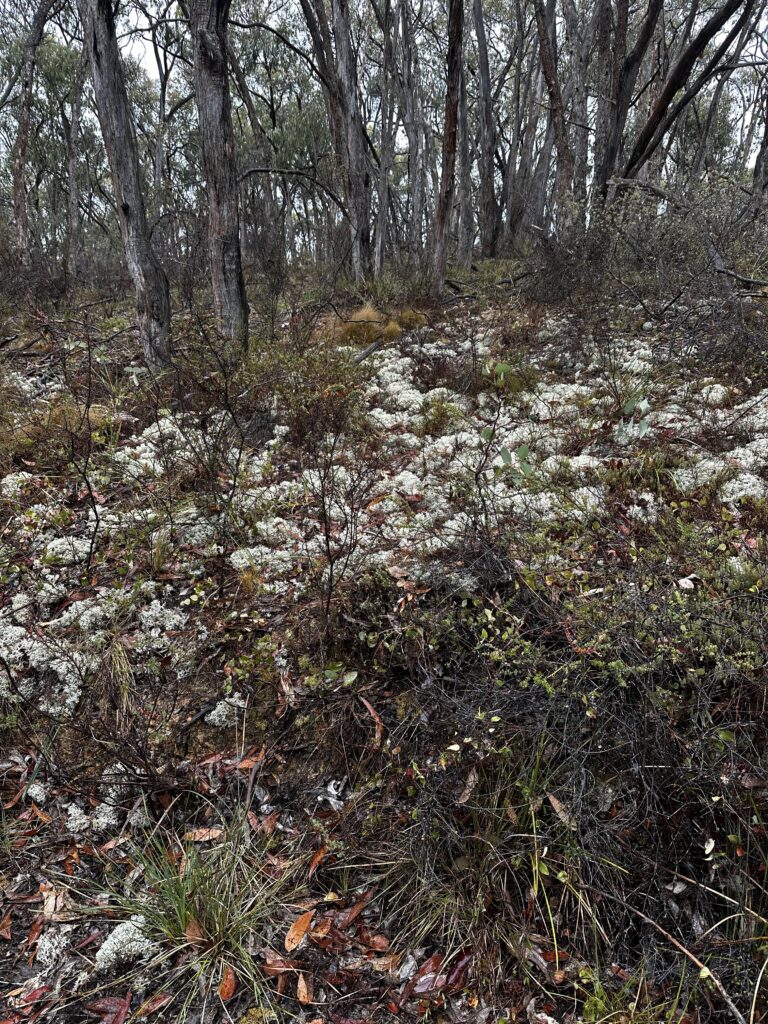
It is widely acknowledged that if we are to heave any chance at addressing the biodiversity and climate crisis, we need to drastically reduce land clearing. But if you look around our Shire, it is very obvious that a 50% increase in the number of houses would require huge amounts of land clearing – destruction of native vegetation and wildlife habitat. We just don’t have enough bare paddocks to accommodate so many houses. What we do have are extensive areas of bushland and a network of important biodiversity corridors, all that would be at great risk from such rapid development.
Local planning schemes have long played a pivotal role in putting the breaks on development and protecting important natural areas, including through zoning and the placement of Environmental Significance Overlays. The Government’s threat to throw all that out the window to allow unhindered development makes a mockery of all their other policies about tackling climate change and environmental protection. Yes, we have a housing crisis which urgently needs addressing, but there are many other ways that this can be addressed that would not involve such irreversible destruction to our natural heritage.
FOBIF will be writing a submission to the State Government on this issue and will continue to advocate for more appropriate planning and development in our region.
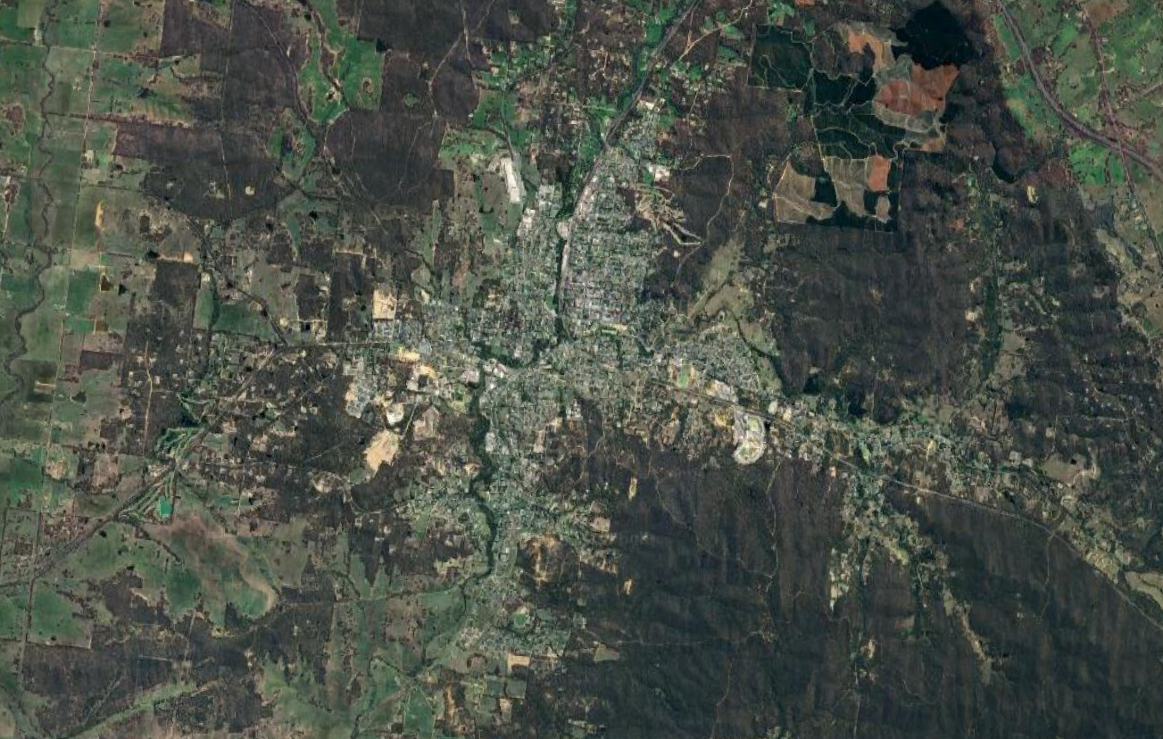
Aerial photo of Castlemaine, showing the current matrix of bushland and habitat corridors surrounding the town.


 Click on image for info/order page
 Click on image for info/order page
 Click on image for info/order page

")


")


