We have had a terrific response to our call for contributions to our FOBIF turns 25 exhibition. You can see all the entries here. The closing date for contributions is in just over a week (31st January). You can find the details here.
Euan Moore and Bronwyn Silver have contributed the following photos and accompanying text.
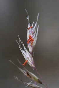
A Visit from the Emperor (Euan Moore)
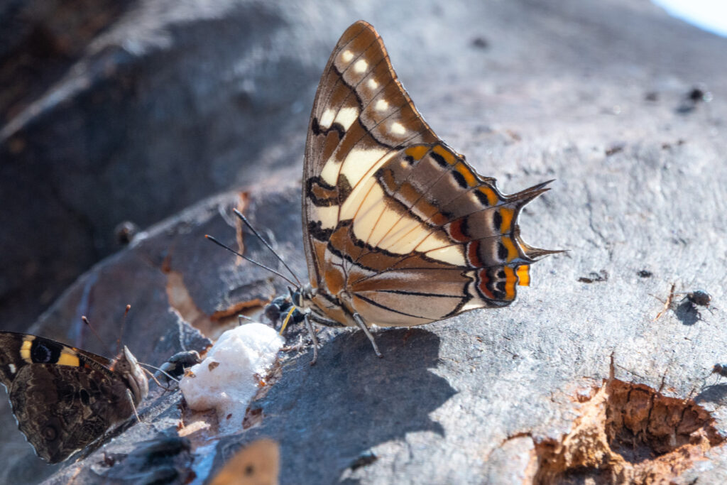
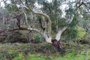
The Sugar Gums at Kalimna Point, while not native to the area, provide resources for many of the smaller animals that live in our forests. One of the larger trees on the slope below the rotunda has been used by Sugar Gliders whose sharp teeth have cut into the bark causing the sweet sap to ooze out. This sap is the nourishment which the Sugar Gliders seek. It continues to bleed long after the gliders have retired to their hollow at sunrise.
The sap provides a bounty for insects that would otherwise be seeking nectar from flowers at a time of year when there are fewer plants in flower. Word, or the scent, had obviously got out. On a warm January morning there was a cloud of butterflies feeding from the Sugar Gliders’ table.
Tailed Emperors are one of our largest butterflies. Their wingspan can be up to 85mm. The photo shows one sharing the ‘table’ with a Yellow Admiral as they feed on the white frothy sap. At the lower right is a scar from an earlier visit by the Sugar Gliders.
There was continuous activity at the tree as the morning warmed up. Common Browns were there by the dozen. There were numerous Yellow Admirals, an occasional Marbled Xenica and of course the Tailed Emperors. There were even a few insects that had become trapped in the sticky treat. Will these be the next round of fossils preserved in amber?
We don’t see Tailed Emperors in Victoria every year. They are more common in northern New South Wales, Queensland and the Northern Territory. There were several sightings around Castlemaine in 2012 but few since until they showed up again this summer. It may be that the very wet conditions further north have enabled their numbers to increase.
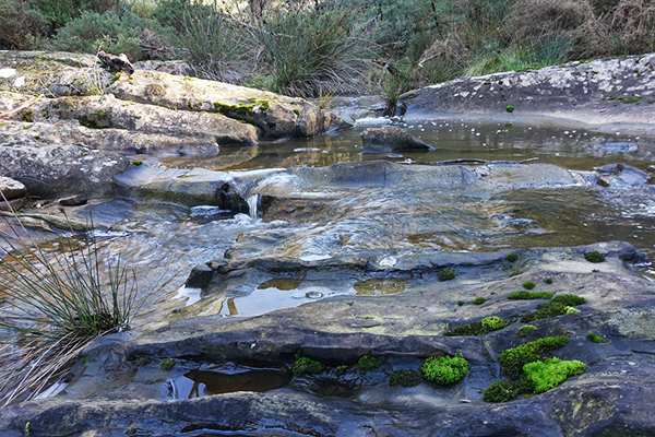
Dawn at Bells Swamp (Bronwyn Silver)
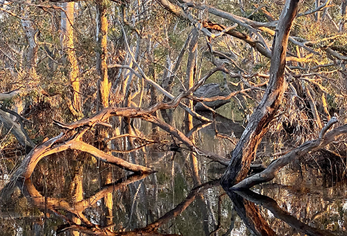
Our region is not known for its wetlands but Bells Swamp covers about 40 hectares at the very northern edge of the Shire. Most of the time passers-by on the Maldon-Bridgewater Road see only an unremarkable area of River Red Gums surrounded by farming country, but in a wet year the swamp becomes a stand-out landscape.
In wet years like 2011, 2016 and again in 2022 it is transformed into a wonderland of wetland birds with the River Red Gums and wetland plant life flourishing after years of drought.
Bells Swamp was dry between 1996 and 2009 but flooding after heavy rains beginning in late 2010 meant the swamp was still more than a meter deep in places in November 2012. After the 2022 rains it is again pretty deep and likely to be flooded for many months.
Reflections of the tangled wetland vegetation are especially stunning at dawn when the light is soft and golden. It’s worth getting up for.


 Click on image for info/order page
 Click on image for info/order page
 Click on image for info/order page

")


")


