Magic mountain


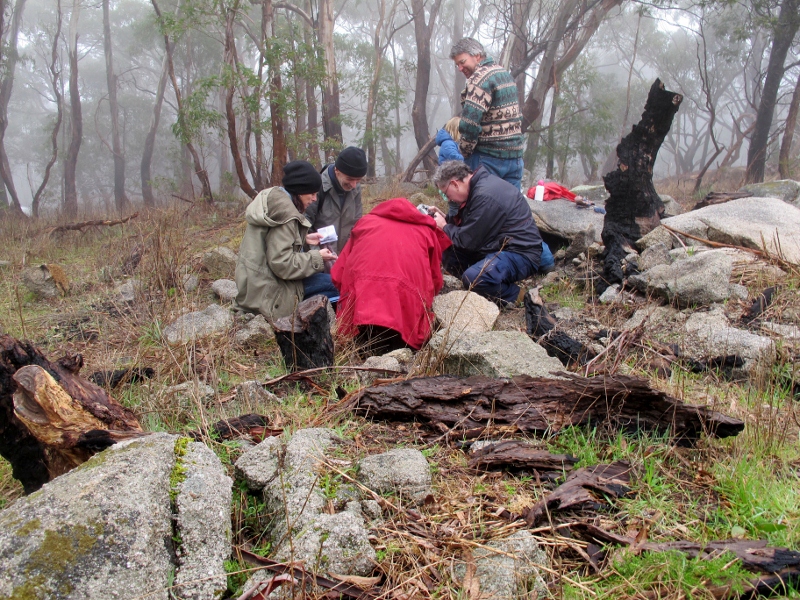
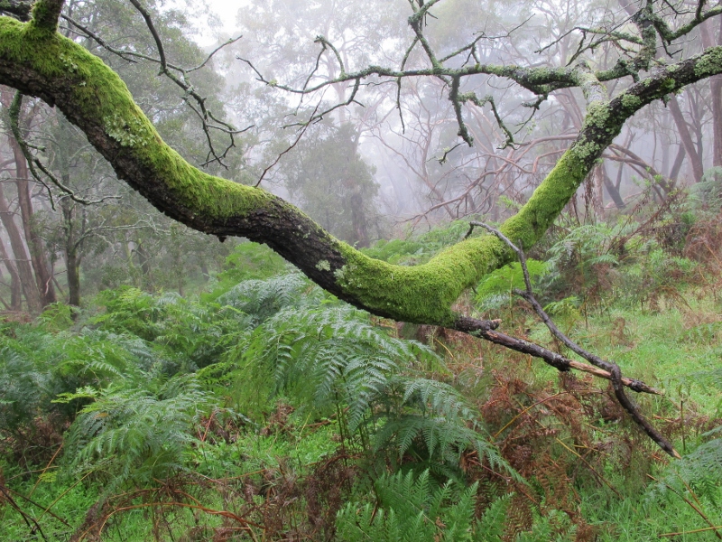
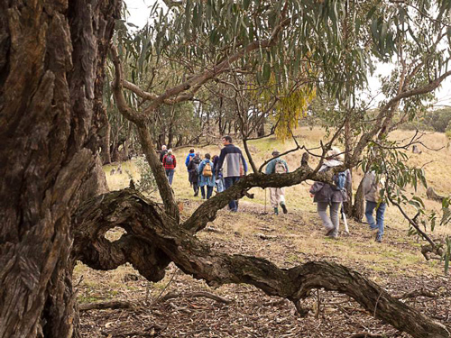
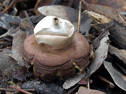
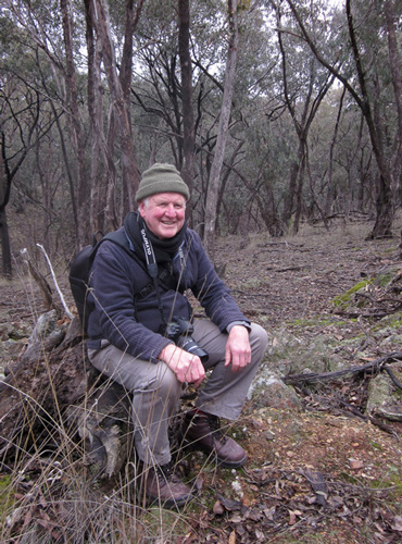
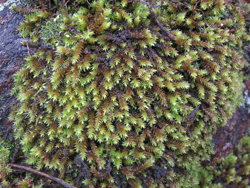
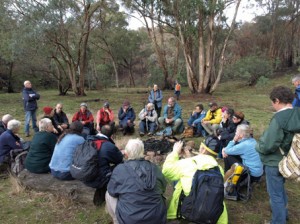
Saturday morning July 28 wasn’t an ideally warm day for crawling around the high points of Mount Alexander, but half a dozen members of FOBIF’s moss group had a pretty interesting time crawling around finding new species to pore over. This time of the year isn’t great for flora, but it’s perfect for mosses, which provide plenty of interest even when when you’re feeling a little, er, cold. The next foray will be in a month. Members interested in coming along should contact us at info@fobif.org.au

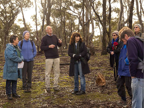
FOBIF's moss group at work. This has been an excellent season for mosses, and Mount Alexander is one of the best places to get an idea of their variety and beauty.


Posted in Moss and Liverwort Field Guide group, News | Comments Off on Magic mountain

Mosaic burning research

The Box Ironbark experimental mosaic burning project is under way. The project is the joint responsibility of DSE, Parks Victoria and Latrobe and Deakin universities. Research in the project will be based around 16 planned mosaic burns of 100 ha each in the Heathcote Rushworth forest. Eight of the burns were conducted in Autumn last year, and eight in Spring. Half of them aimed at 35-50% burn coverage and half at 75-90%.

The project’s monitoring program focuses on questions like:

–How do different mosaic burns affect the composition of plant communities?

–Does burning stimulate germination of additional plant species from the soil seed store?

–Do mosaic burns cause changes in the density of tree stems in the forest?

–Are logs, stumps and areas of deep litter lost at disproportionate rates due to high flammability?

–Do planned burns alter the composition of woodland bird communities?

–How does fire affect the movements, foraging behaviour and breeding success of individual birds?

–Do burns result in an increase in the home range size of the Yellow-footed Antechinus?

–Do fires result in a loss of den sites for the Yellow-footed Antechinus?

You can get more details and keep abreast of news about this project by getting on the mailing list for its newsletter. Write to the project officer, Greg Holland at Deakin Uni: greg.holland@deakin.edu.au


Posted in Fire Management | Comments Off on Mosaic burning research

FOBIF walk in Sandon

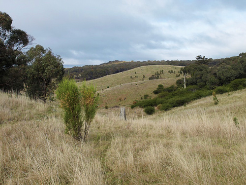
View to the east. Mount Franklin can be seen in the distance. Photo by John Ellis

The July FOBIF walk was to Malcolm Fyffe’s property in Sandon. This was a much appreciated opportunity to visit a farming property with lush undulating pastures and spectacular views.

Malcolm gave running commentary on the history of the property. Glenwillow has been farmed by his family since the 1940s and after a career in teaching Malcolm took over management of the farm. Over the past few years assisted by Bush Tender funding he has been able to improve and rehabilitate the property by erecting fencing to keep out stock from existing vegetation and waterways. He has also worked on weed and pest control and undertaken strategic plantings.

Stand of Hedge Wattle. Photo by Noel Young

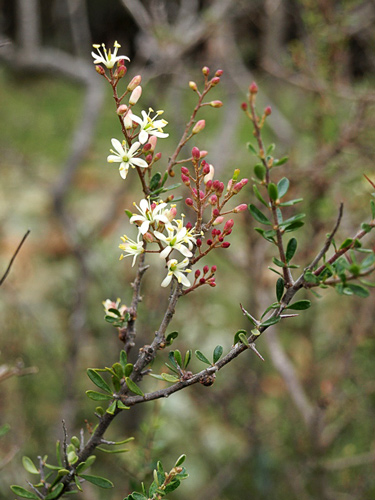
The differences in soil and rainfall in this area which is to the south of Castlemaine have resulted in comparatively vigorous growth on common local plants such as coffee bush and hedge wattle.

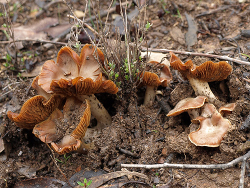
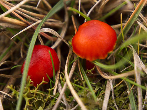
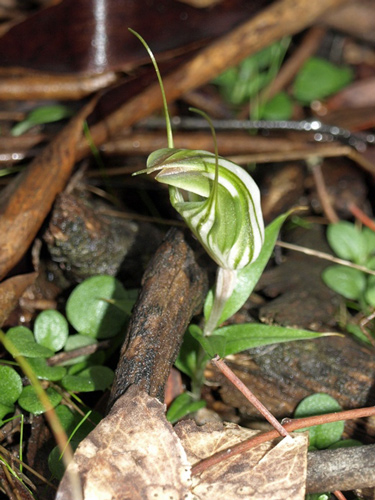
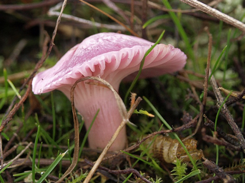
Finds of particular interest were unusual fungi including some that were pink and bright red and a Striped Greenhood Pterostylis striata. These plants and other scenes from the day can be viewed in the slideshow below. The photos were taken by Noel Young, John Ellis and Bronwyn Silver.

Posted in News | Comments Off on FOBIF walk in Sandon

FOBIF photo exhibition ends

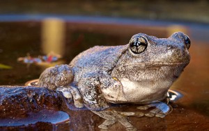
Peron's Tree Frog--Litoria peronii. Photo by John Ellis

FOBIF’s Mamunya photo exhibition 2012, which ended last week, was the most successful yet. A record number of photos was sold, and we were pleased with the attention paid by the public to the notes attached to the photos. We’re particularly grateful to the kind soul who corrected our mistake the scientific name for Peron’s Tree Frog– an unaccountable error fortunately not repeated in the photo in our picture gallery.

Posted in News | Comments Off on FOBIF photo exhibition ends

A new Code of Practice arrives

DSE’s 2012 Code of Practice for Bushfire Management on Public Land is now out. It can be found here. Readers will remember our discussion of the draft  of this document last year. This version is significantly changed from that draft.

For a start, the name is different: the change from Code of Practice for Fire Management to Code of Practice for Bushfire Management  may indicate a shift in emphasis: the focus now seems less on seeing how fire works in the environment, and how its beneficial effects can be maximised and its destructive effects limited. Now the focus seems to be primarily on bushfire prevention and moderation. This may simply clarify what has been the case in practice, or it may indicate that there has been a definite shift away from environmental concerns towards straight out safety matters. We’ll have to wait and see on that: on the one hand, sections in the draft Code requiring DSE to develop a fire ecology strategy, and support research, have been removed; on the other, the Code still commits the Department to act on the basis of scientific research, along the lines recommended by the Royal Commission. How this research is to be conducted and applied is, as always, an interesting question.
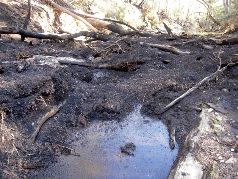
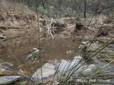
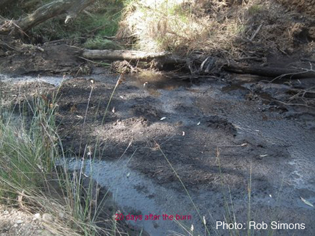
'‘The Department will seek to protect soil by measures which minimise damage to its physical and chemical properties or which promote stabilisation of bare earth following disturbance…The Department will seek to protect water quantity and quality by measures that minimize the impact of bushfire management activities...' Tarilta creek after DSE burn, March 2012.


The Code repeats the dual aims of its predecessors:

‘There are two primary objectives for bushfire management on public land:

‘• To minimise the impact of major bushfires on human life, communities, essential and community infrastructure, industries, the economy and the environment. Human life will be afforded priority over all other considerations.

‘• To maintain or improve the resilience of natural ecosystems and their ability to     deliver services such as biodiversity, water, carbon storage and forest products.’ [p. 1]

The second aim is expanded as follows on page 5:

Continue reading

Posted in Fire Management, News | Comments Off on A new Code of Practice arrives

Fire consultations continue in Bendigo

Conservation groups [including FOBIF], apiarists and concerned individuals met with DSE representatives in Bendigo last Thursday to discuss the upcoming Fire Operations Program [FOP]. The meeting was organised by DSE and the North Central Victorian Combined Environment Groups.

DSE fire management officer Simon Brown outlined the process by which the FOP is developed, and he and other DSE officials fielded questions from the community members, who came from an area encompassing Echuca, Graytown, Taradale, Castlemaine, Muckleford and Bendigo.

All discussion was limited by the acknowledgement that the policy of burning five per cent of public bushland every year is non-negotiable at this level: the policy is determined not by DSE but by the State Government, and appears to have wide public support. Any changes in that policy will have to come via community debate and subsequent political change. [It’s hard if not impossible, however, to find anyone directly involved with the policy who likes it or feels that it’s doing any good in this region]. Discussions therefore concentrated on how the policy can be implemented with minimum environmental and economic damage while achieving public safety objectives.

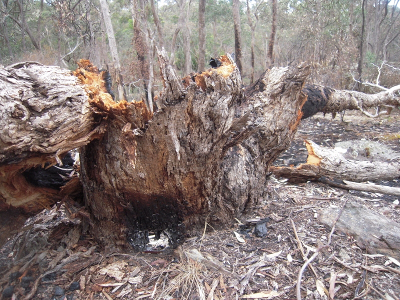
Sailors Gully, in the Quartz Hill burn, 2011: destruction of large trees under the present system seems inevitable, although all agree that it amounts to serious environmental and economic damage.


Here are some of the points which emerged from the four hour session:

  • DSE’s target this year is to burn 12,000 ha, and in following years 13, 668 ha per year. In addition 1,000 ha will be treated by slashing and other fuel reduction methods. These ‘alternative’ methods are not included in the five per cent target.
  • Apiarists believe that the policy of burning Zone One areas every five years will destroy nectar production in those areas within 20 years. Beekeepers would like to see less intense burns, and DSE acknowledges that ‘we’d like to fuel reduce areas without intense burns.’ Efforts to achieve this have involved experimenting with night time burns, but it seems clear that pressure to achieve targets is going to compromise efforts to improve the quality of what is done.
  • Environmentalists object to spring burns on the grounds that they affect seed setting and breeding patterns—but winemakers insist on them, because autumn burns cause smoke taint in grapes. DSE has to find a compromise between these opposing views.

Continue reading

Posted in Fire Management, News | Comments Off on Fire consultations continue in Bendigo

Mount Alexander Roadside Conservation Management Plan

Council is currently seeking community input and feedback to the Draft Roadside Conservation Management Plan. The Plan contains eighteen actions to guide Council’s roadside operations and protection works, including improving communications with the community, Landcare and other agencies about roadsides.

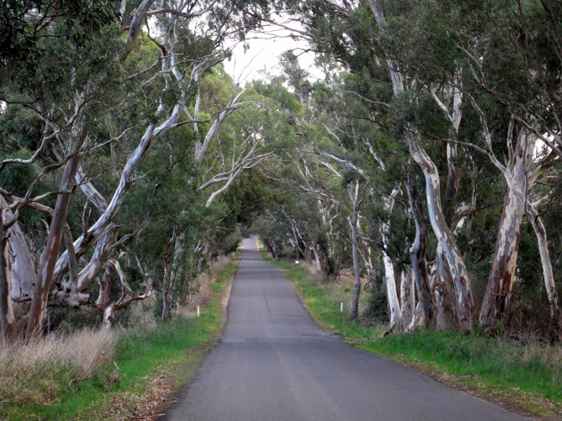
In 2008 the Catchment Management Authority ran a detailed ecological survey which found that 19% of Mount Alexander Shire’s roadsides had high conservation value, and a further 28% were of medium conservation value: that’s 1090 kilometres of roadsides with interesting stuff worth careful management: and given the Shire’s obligations to road safety and fire prevention, it’s not a simple matter.

Sutton Grange road: over a thousand kms of the shire's roadsides have reasonable conservation values, but careful management will be needed to ensure these values are preserved.


There will be a listening post session at the Maldon Neighbourhood Centre (corner Church and Edward Streets in Maldon) on Wednesday 18 July from 11.30am to 1.30pm. 

On the following day, Thursday 19 July, a session will be at the Ray Bradfield Room in Castlemaine from 6pm to 8pm for light supper, brief presentation and discussion.

You can find the draft plan at  www.mountalexander.vic.gov.au/roadsides along with a link to an online survey where you can make comments about the Plan. Enquires can be sent to Kylie Stafford, Council’s Natural Environment Officer, at  k.stafford@mountalexander.vic.gov.au or 5471 1700. The survey will be open until 5pm Thursday 26 July 2012.

Posted in News | Comments Off on Mount Alexander Roadside Conservation Management Plan

CFNC Meeting: Native Grasses and the Moolort Plains

On the evening of 13 July there will be a special Castlemaine Field Naturalist Club meeting where Ern Perkins Central Victoria Grasses Identification Guide CD will be launched and Geoff Park will give a presentation on the Moolort Plains. To find out the full details see the Connecting Country website.

Posted in Nature Observations | Comments Off on CFNC Meeting: Native Grasses and the Moolort Plains

Get the birds at the AGM

Here’s advance notice that FOBIF’s Annual General Meeting will take place at Castlemaine Continuing Education Centre at 7.30 pm on Monday August 13.

After the usual business, there will be a short talk by Damian Kelly on the challenges and rewards of bird photography. Readers of this site will be familiar with Damian’s brilliant photos of local bird life, and he will illustrate his talk with some recent examples.

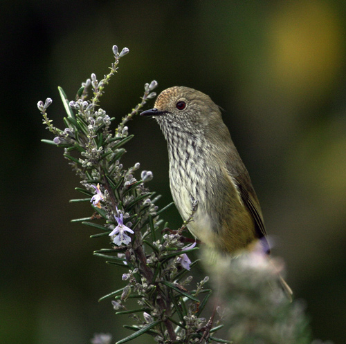
Brown Thornbill. Photo by Damian Kelly. This is one of three photos of birds by Damian included in the current FOBIF exhibition at Togs Cafe.


Posted in News | Comments Off on Get the birds at the AGM

Walkers in a Blackened Landscape

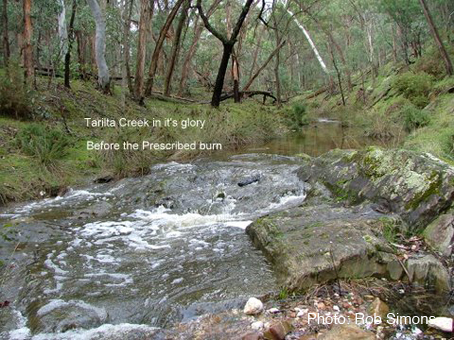
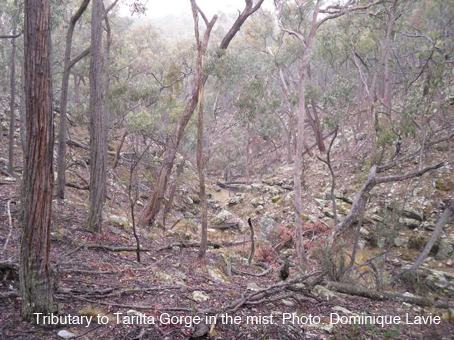
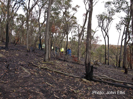
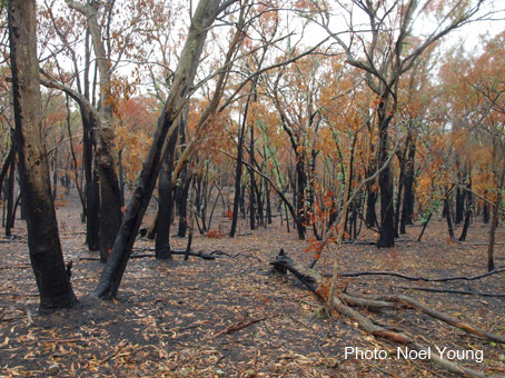
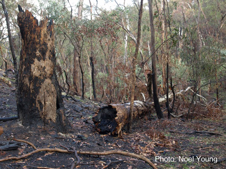
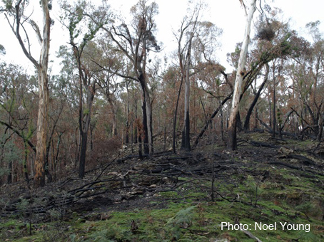
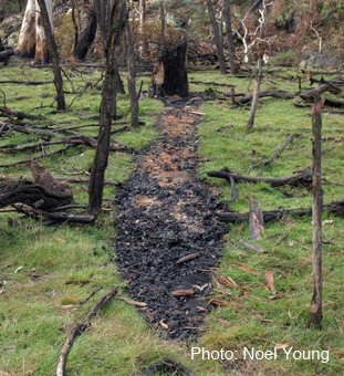
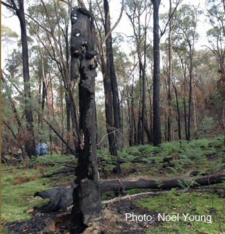
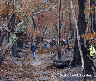
The June FOBIF walk led by Doug Ralph was to the remote Tarilta Creek Valley. Readers of this site will know that this area was the subject of controlled burn this Autumn. (See previous FOBIF post.) The day allowed walkers to see the effects of this burn first-hand.

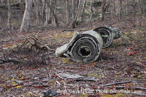
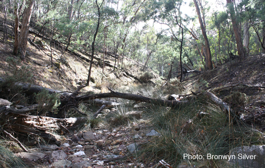
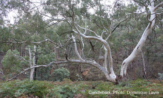
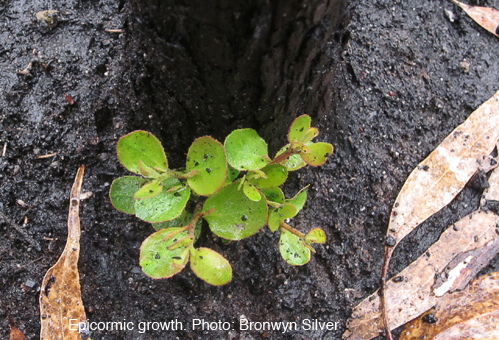
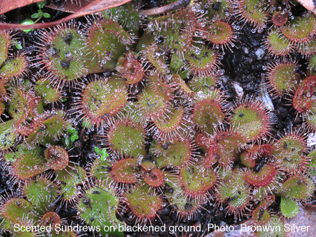
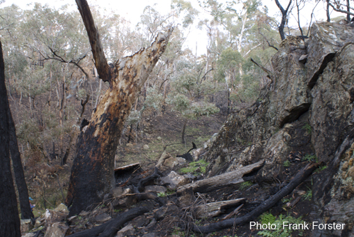
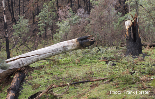
Most of the walk was through bush that had been devastated. Mature trees were lying burnt on the ground and severe erosion was evident as a result of  the burning of steep slopes. Consequently parts of this once beautiful creek were now full of black silt. Apart from epicormic growth on burnt trees and some ground covers such as Scented Sundews there was little evidence of recovery. One of the walkers, Noel Young, commented:

I was dismayed by the number of large mature eucalypts that were completely destroyed in the bottom of the valley.  This represents the destruction of much needed wildlife habitat which has taken maybe 50 to 100 years to grow.  I doubt if this was intended, but it probably reflects the methods used, ie, weapons of mass destruction (fire bombing) with little or no ground supervision.  Hardly a “controlled burn”.

Below are two slideshows. The first one contains photos of Tarilta Gorge before the controlled burn. The second collection contains photos taken after the burn including on the walk.


At the end of the walk there was a short discussion led by Doug about the area and the effects of the burn. Mount Alexander Shire Councillor, Christine Henderson, spoke about the Municipal Fire Plan which has just been released and encouraged walkers to submit comments to Council about the burn in this area based on their observations. See recent FOBIF posts here and here for more detail on this.

The July FOBIF walk on 15 July will be to the McKinnon property at Yandoit. Malcolm Fyffe will be the leader.


Posted in News | Comments Off on Walkers in a Blackened Landscape