Bird discovery tour

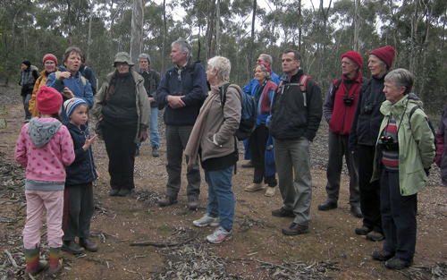
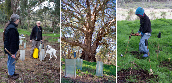
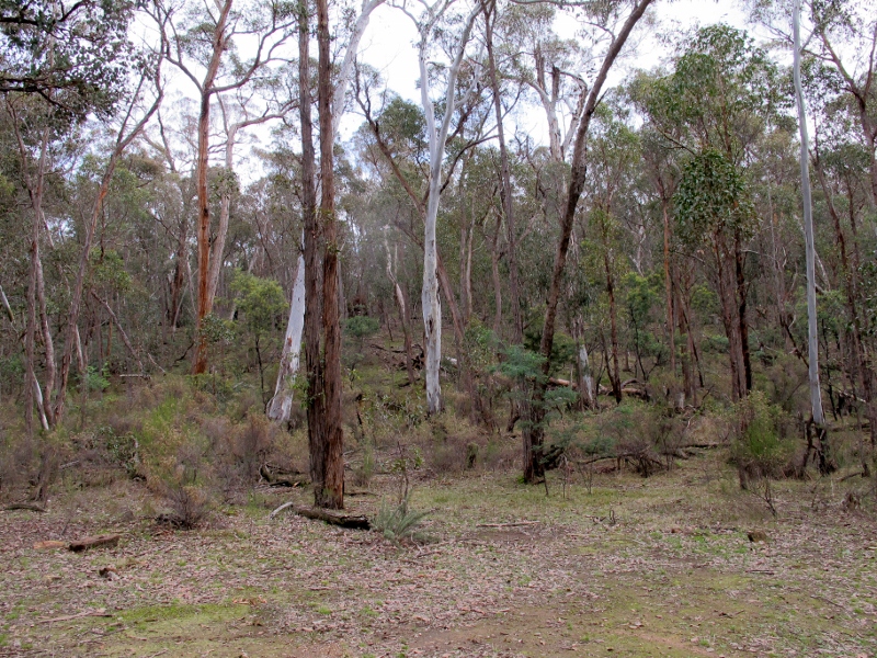
Thirty-seven people came along to Geoff Park’s recent FOBIF walk in the Muckleford Forest. The focus was on birds and despite the large group it was possible to see and hear a fair range. These included Striated Thornbills, Weebills, Grey Strike Thrushes, Galahs, Grey Fantails, Rufus Whistlers and Brown Flycatchers. Many in the group were familiar with Geoff’s blog, Natural Newstead, and appreciated the opportunity to pick up some tips on how to find and identify birds as well as seeing some of his favourite spots.

Geoff Park with some of the walkers

The next walk is 16 September. We will be going to the south end of the Castlemaine Diggings National Heritage Park. The walk will be led by Bernard Slattery. Click here for more details.

Posted in News | Comments Off on Bird discovery tour

Zone 3: what’s going to happen there?

As we reported on our website last month, DSE has released the draft Fire Operations Plan for consultation. Although FOBIF has many concerns about the plan, and urges members to consult it and make a submission based on their local knowledge, we are urging you here to focus on proposed burns in Zone 3. These are burns generally relatively remote from settlement, and have in the past on paper been devised principally for ecological reasons.

The draft DSE Fire Operations Plan proposes several significant Zone 3 burns in our region in the next three years. The stated purpose of these exercises is: ‘to provide an irregular mosaic of areas of fuel reduction which will complement works in adjacent fire management zones and can assist in ecological resilience and forest regeneration.’ All burns are proposed for Spring between now and 2015:
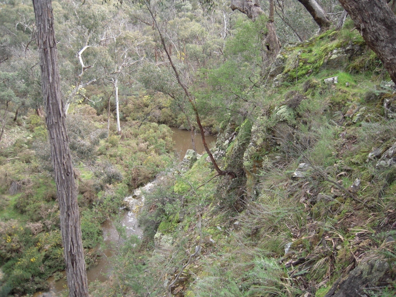
Brown's Gully, Castlemaine Diggings NHP: FOBIF is getting mixed messages about how much of this bush is to be burned, and what attention if any will be paid to ecological values. It's up to the public to urge that DSE follow its own policies on Zone 3 burns.

Muckleford: Dunn’s Reef—257.6 ha [CAS 11] and A Frame Tk—319.9 ha  [CAS 12]

Maldon: Donkey Farm Tk—188.4 ha [CAS 10].  Nuggettys –274.7 ha [CAS 5]

Chewton: Railway Dam—193.4 ha [CAS 13]

Taradale: Plantation Tk –151.7 ha [CAS 17] Carnell Rd—225 ha [CAS 14]

Glenluce: Amanda’s Tk 409.3 ha [CAS 15]

To find maps of these proposed burns, go to the DSE website:

FOBIF and other interested groups were told by DSE in July that the objective in zone 3 is to aim at ‘at least 20%’ of burn coverage: that is, to burn 20+% of each named parcel, perhaps up to 35%. However, we have been told recently by fire operatives that they aim to burn 50% of each zone 3 parcel [This confirms our observations of past Zone 3 burns, some of which go much higher than 50%]. Further, although the DSE Code of Practice and the stated aim of the burn as we have quoted it above requires a clear ecological perspective on the burn, we have been reliably informed that the intention of these exercises is purely fuel reduction.

It is important that pressure be exerted on DSE to implement its own stated policy regarding the use of fire for ecological purposes.

You can make a difference by writing a short submission to DSE by August 31:

Continue reading

Posted in Fire Management | Comments Off on Zone 3: what’s going to happen there?

The view from St Arnaud

The St Arnaud Field Naturalists Club has made a detailed submission to DSE regarding the draft fire operations plan for the St Arnaud area. Below we reprint part of the covering letter attached to the submission. Although of course conditions vary from district to district, readers will notice that many of the concerns expressed here overlap with our own [Please note that ‘ecological management zones’ have now been renamed ‘landscape management zones’. DSE signage is sometimes out of date]:

‘…We note that all areas listed [for burning] are labelled “Ecological Management Zone”; we believe this to be misleading as there is no reason to manage the ecology of the areas by burning, ie., there are no fire-dependant species. Burning will produce a simplification of the understorey remaining after 15 years of intense drought and heavy grazing by kangaroos. Already, long-term (more than a decade)studies by both our group and Monash University researchers show that habitat degradation and simplification(loss of species) have resulted in a decline in the number of bird species using our bush areas as well as a serious decline in the number of birds within all species. This decline continues despite two years of above average rainfall. Further loss of the integrity of our Park and allied reserves will mean a further decline in species.

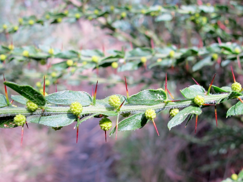
Hedge wattle, August 2012: spring burning is a contentious issue because of its effects on flowering plants and breeding birds and animals.


‘For the National Park and Reserves, loss of the remaining understorey and ground litter layer will result in increased soil temperatures leading to loss of soil microbiota- the basis of the entire food chain; loss of soil moisture resulting in

Continue reading

Posted in Fire Management, News | Comments Off on The view from St Arnaud

Little Monster?

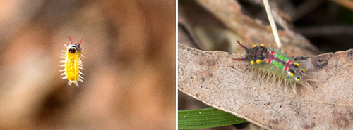
The beautiful creature pictured below is an early instar caterpillar, from the genus Doratifera, probably Doratifera oxleyi. These moths are commonly called cup moths. It was found in suspended by a thread in an area of severely damaged bushland in the Diggings Park this week.

Cup moth caterpillar: It’s less than a centimetre long, and you can’t deny it’s pretty— but don’t touch it! We’re not sure if it’s the creature that’s eating our bushland. Photo: Bronwyn Silver, 14 August 2012

Cup moths Cup moths ‘belong to a small group of moths that have unusual slug-like caterpillars that are often beautifully marked and coloured. They derive their name from the cup shaped cocoons made by the caterpillars when they pupate. There are several different species of cup moth that feed on eucalypts and other native plants. The caterpillars differ in colour, pattern and size but they all have the characteristic slug-like appearance with clusters of spines on their bodies. The spines can inflict a sharp and painful sting, rather like a nettle and the caterpillars are often known as ‘stingers’.  The stings may cause local inflammation if they touch bare skin.’ [ref: Department of Primary Industry, SA]

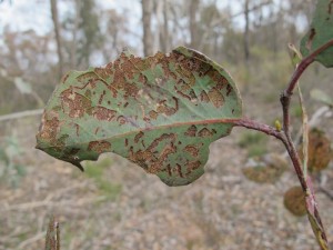
We mistakenly reported last week that the enormous damage inflicted on eucalypts in the south end of the Shire was caused by lerps. Now we believe that the damage is caused by a leaf miner of some sort, and have suspicions about the cup moth–but we’re not sure. Theories are invited.

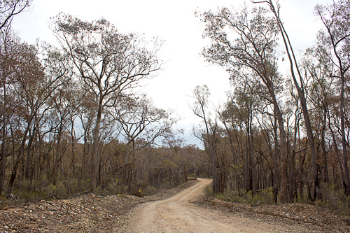
Porcupine Ridge Road: eucalypts in the South of the Shire are being devastated by a leaf eating creature. Photo: Bronwyn Silver, 14 August 2012

Posted in Nature Observations, News | 6 Comments

Restoring the Moolort Wetlands

Nick Layne from North Central CMA will be giving a presentation on Restoring the Moolort Wetlands at a Newstead Landcare Group meeting this Thursday. These wetlands are west of Newstead and adorned with numerous stunning Red Gum swamps which, when full, become home to countless waterbirds, including Brolgas. This is a chance to learn about these magnificent swamps and their wildlife as well as the exciting new project to restore them to their full glory.

The meeting will be held at the Newstead Community Centre at 8 pm on Thursday 16 August. A gold coin donation will be appreciated.

Posted in News | Comments Off on Restoring the Moolort Wetlands

Looking after a Yellow Box

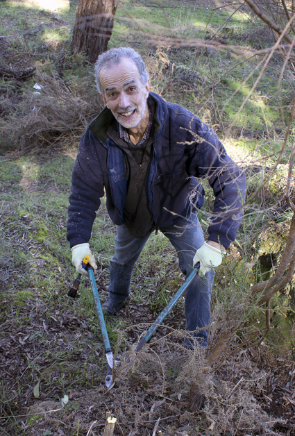
As part of National Tree Day on the morning of 29 July, 15 volunteers planted 240 indigenous plants under the ancient Yellow Box tree at Chewton. Low plants, ground covers and shrubs were planted under the tree and larger shrubs including Rough, Hedge and Golden Wattles and Bushy Needlewoods were planted further away. A grant from Mount Alexander Shire was used to buy these plants from Frances Cincotta of Newstead Natives.

Although the main effort was put into planting, people also removed small bridal creeper plants that had survived last year’s eradication work by FOBIF. A few days after the planting several FOBIF members attacked the infestation of gorse on the bank between the Yellow Box tree and the Great Dividing Trail. We are hoping that future walkers will be able to enjoy this beautiful spot without being confronted with masses of gorse and bridal creeper. As well the understorey plants will promote the health of this magnificent tree.

Alex enthusiastically attacking the gorse.


Posted in News | Comments Off on Looking after a Yellow Box

Forests under attack from leaf miner

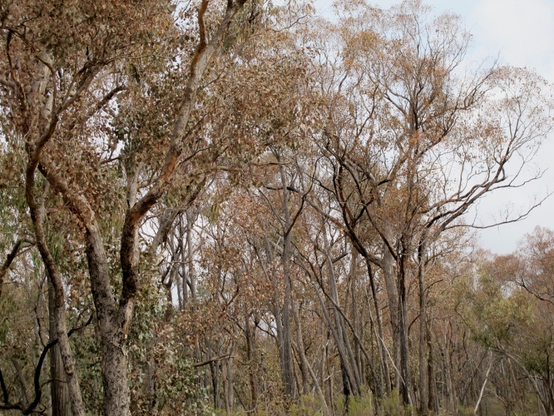
Visitors passing along the Porcupine Ridge Road in recent weeks have noticed that trees on both sides of the road, both in the National Heritage Park and the Upper Loddon State Forest, are looking extremely stressed, presenting a desolate sight.  The cause appears to be a plague of lerps. Such a plague usually reflects a decline in the number of woodland birds which normally feed on lerps. [SEE OUR AUGUST 16 REVISION OF THIS ASSESSMENT]

Distressed trees near the Helge Track: bush health is dependent on biodiversity, and low bird numbers suggest that we may be in trouble.


This decline is alarming from many points of view. The current condition of this bush is an indicator of the connection between biodiversity and forest health. Castlemaine Field Naturalists report that the ‘decline in bushland birds is alarming.’ Their

Lerp attack: the absence of woodland birds is not just a problem for bird watchers.

monthly bird counts at the Spring Gully/Fryerstown Road intersection reveal that the number of species seen, and the number in each species, have been declining for some time. The counts for 2012 are
January nil
February nil
March nil
April Scarlet Robin (1)
May Aust Raven (1)
June nil
July nil
August nil’.

DSE draft fire operations plans propose big burns to the south and west of this area [see our report below].

Posted in Nature Observations, News | 2 Comments

Fire Operations Plans: have a look!

Draft fire operations plans are now out. DSE proposes three burns in the Muckleford forest, two major burns in the vicinity of Tarilta Creek and Middleton Creek, and several burns closer to Castlemaine township, including Kalimna Park. Details can be found on the DSE website, as follows:

1. Mapshare interactive map – Fireplan

http://nremap-sc.nre.vic.gov.au/MapShare.v2/imf.jsp?site=fireplan

This is a sophisticated mapping interface where you can turn different layers (spatial information) on and off to view.

2. Proposed Fire Operations Plans

http://www.dse.vic.gov.au/fire-and-other-emergencies/planned-burning-an-introduction/proposed-fire-operations-plans

This is a simplified interactive mapping interface where you can zoom to different areas and view the proposed FOP which is now open for comment. This provides some information about which year the different burns are planned for.

Continue reading

Posted in Fire Management, News | Comments Off on Fire Operations Plans: have a look!

FOBIF response to fire operations plans

The following is FOBIF’s draft submission on the Fire Operations Plan [see above]. Member feedback is invited:

GENERAL COMMENTS

1. We believe that as far as possible, burn areas be small: less than 100 ha. In zones 1 and 2, they should be smaller than 50 ha. In our opinion, this would make it easier for managers to pay close attention to ecological values, something hard or impossible with large hectare burns.

2. DSE should where possible integrate weed and fire management in the burn plans. We note that integration of weed management and bushfire control is part of the Mount Alexander municipal fire plan.

Middleton Creek, Castlemaine Diggings NHP: Common sense dictates that steep slopes should not be burned, and that important old trees not be destroyed.


3. In Zone 3 burns, unless it is possible to guarantee that burn cover will not exceed 20% [that is, unless it is possible to guarantee a genuine mosaic burn], and that vulnerable areas [eg, steep areas, or areas of particular interest, like large trees, creeksides etc] can be protected, we believe that managers should aim to burn precisely defined areas within the treatment zone. We would like to have access to the Zone 3 burn plans for our area.

4. Spring burns should be avoided.

Continue reading

Posted in Fire Management, News | Comments Off on FOBIF response to fire operations plans

Monitoring report advises abandonment of 5% target

The independent Bushfires Royal Commission Implementation Monitor, Neil Comrie, has released his July 31 report on the progress of implementation of the Commission’s many recommendations.

The Monitor’s report takes aim at the five per cent burning target: it  ‘questions the rolling target as the most effective way to increase the level of planned burning across the State as working towards a predetermined target may diminish the State’s ability to focus on risk reduction in high risk areas. The  [Implementation Monitor] advocates that the State reconsider the planned burning target of five percent as the primary outcome as part of the planned burning reform program. It is considered that the most important objective of the planned burning program must be to address public safety risks in line with [the Royal Commission’s] intentions.’ [p 8]

Behind this rather bureaucratic language is the clear implication that concentrating on burning thousands of hectares a year is actually distracting the State from its supposed primary objective: to protect human life.

Continue reading

Posted in Fire Management | Comments Off on Monitoring report advises abandonment of 5% target