FOBIF walk in Maldon Historic Reserve

A group of 20 eager bushwalkers emerged from their summer hiatus to participate in the first walk of the 2013 FOBIF calendar.  The walk was led by Chris Johnston, who has built up a considerable body of knowledge about the Maldon Historic Reserve and the Muckleford Forest. 

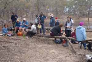
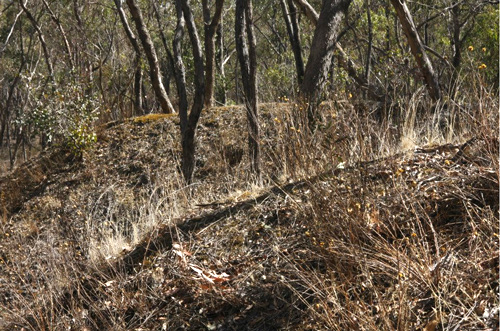
The walk commenced at the ruins of the Gowar School and wended its way through impressive box-ironbark forest up to Smiths Reef Dam, built in 1860.  A number of native under storey species were identified along the way.  Following a break for morning tea at Smiths Reef Dam, the group explored a number of the digging sites to the east of the dam.   

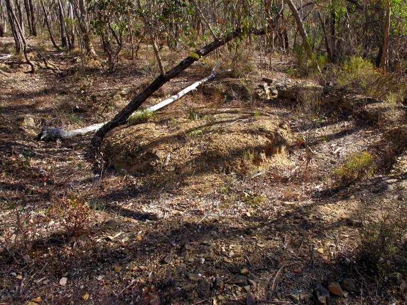
Hairy mullock heaps. Photo by Dominique Lavie


Photo by Dominique Lavie

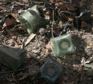
A disturbed bottle dump was located with many fragments of old bottles still present.  The archaeological knowledge of one of the walkers (from Kyneton) was put to good use in describing the style of the bottles, the production processes and the possible uses.

The walk continued along the Spur Track with a marked contrast observable in the vegetation on either side of the track resulting from previous prescribed burns.


Photo by Frank Forster

A lunch break was taken in the lee of a large rocky outcrop providing an interesting micro-climate for small ground covers, ferns and lichen.

After lunch the group returned along Clarry’s Track and the Gowar Road, taking note of the areas designated for prescribed burns in autumn 2014.  Chris Johnston is coordinating a data collection exercise in the designated area and is seeking a few volunteers to assist in the process.  This is scheduled for Sunday 14 April;  please email mucklefordffg@bigpond.com if interested.

This walk was a great start to the 2013 program, and thanks are due to Chris Johnston for her detailed preparation and informed guidance. You can view more of Dominique Lavie’s photos by clicking on her Facebook page.

Posted in News | Comments Off on FOBIF walk in Maldon Historic Reserve

The Selwyn Map: ‘quiet, calm…terrible, disturbing’

It’s a map ‘full of quiet calm, still, beautiful’, says Latrobe University historian Gerry Gill. There’s a ‘soft, comfortable, nostalgic light’ in it. But it’s also ‘terrible, disturbing’.

Gill is referring to the Selwyn map, produced in 1852 and showing the area between the Campaspe and Loddon Rivers, with Mount Alexander at its centre.

You can have a look at the map via our 2011 Post. It is in fact very beautiful, but Gill’s point is that it is a document which essentially records the state of the environment as it was under Aboriginal management. By showing numerous squatting stations on the best land, it is also a record of dispossession.

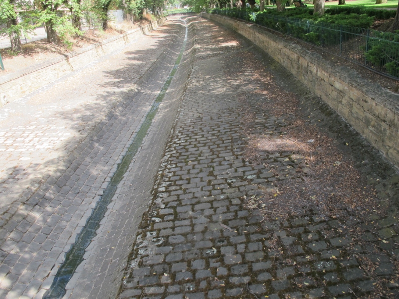
Bendigo Creek. Early observers watched kingfishers and platypus in the creek. A Royal Commission recommended the engineered gutter solution to the destruction wrought by gold seekers.


The map is on display at the Bendigo Post Office Gallery. It’s part of an exhibition which also includes two short films made by Gill, one on the map itself, and the other on the history of the Bendigo Creek. Gill quotes an early observer of this creek, entranced by the sight of kingfishers and platypus. Within a short time the creek had been reduced to a channel for noxious sludge pushed 160 kilometres north of Bendigo and covering 700 square kilometres of productive land with hardened clay. The creek, says Gill, struggled to survive against early gold seekers, but was finally finished off by the puddling machine [see our post on this ingenious device]. After Royal Commission enquiry into its dreadful state, it was engineered into the gutter we know today.

The exhibition runs till June 16. Don’t miss it: and there are numerous associated talks and events.

Posted in News | Comments Off on The Selwyn Map: ‘quiet, calm…terrible, disturbing’

Don’t try this yourself!

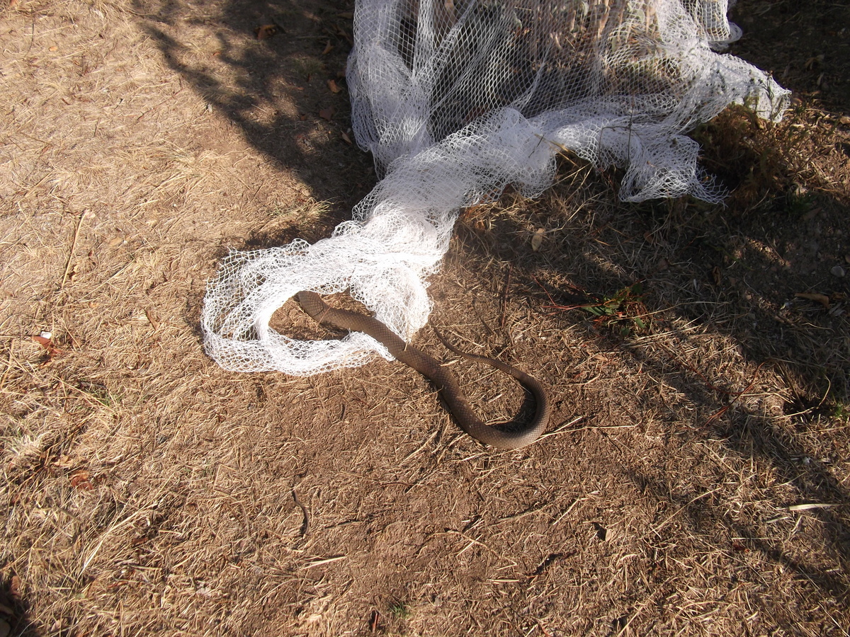
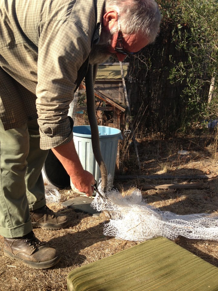
Bird netting which lies loosely on the ground can be a menace to small animals like echidnas…and also to snakes, as the picture below shows.

Doug Ralph was asked by a local to help out when a brown snake about two metres long became entangled in netting dragging on the ground.

Eastern brown snake caught in bird netting, Castlemaine: nets which drag on the ground can entangle small animals, with sometimes dangerous results.Photo: Doug Ralph


This situation isn’t good for anyone–the snake, which could die from the exhaustion of trying to get away, or any person who may lack the expertise to deal with a potentially dangerous creature.

Snake rescue: definitely not recommended for non experts. Photo: Jan Hall


Doug’s method is illustrated above: lift the snake, cut the netting away, then put the creature in a bucket and take it out into the bush. We don’t advise anyone without the expertise to attempt this, however. The Eastern (or Common) Brown is extremely venomous, and becomes aggressive if threatened.

The moral is: don’t let your bird netting drag loosely on the ground.

Posted in Nature Observations, News | Comments Off on Don’t try this yourself!

‘Castlemaine’s first environmental cause’

The curious circular earth formation pictured below isn’t a mysterious religious site. It’s a puddling wheel, and if you want to know how it used to work, check out historian Marjorie Theobald’s article ‘Commissioner Bull and the Puddling Machines: Castlemaine’s first Environmental Cause’:

Puddling machine, Cobblers Gully: Circular ditches like this, with islands in the middle, are fairly common in our district. The fallen trees are recent intrusions--natural heritage at work.


‘In the years 1851-1855 the area known as the Mount Alexander gold fields, about ten square miles including the towns of Castlemaine, Chewton and Fryerstown, was ransacked by the alluvial miners; no creek was left unchanged, no gully was left unscarred, no ridge was left unpierced. Concern for the environment as we understand it today did not exist. It comes as a surprise then to find that in January 1855 Resident Gold Commissioner for Castlemaine, J.E.N. Bull, took a stand on precisely these grounds: he sent to each proprietor of a puddling machine an edict that from the 31 March 1855 these machines would be banned from the main creeks in his district. This was necessary, he wrote, to safeguard the water supply of Castlemaine, the operations of the miners using cradles and Long Toms, and the health of the creeks and flats generally.’

What happened next? To find out, check Marjorie’s excellent article on the online Central Victorian Ecology blog.

Posted in News | Comments Off on ‘Castlemaine’s first environmental cause’

Flood management plan on the way?

About 100 people turned up to the first public consultation meeting on flood management on February 18 at the Castlemaine Town Hall.

The meeting consisted of three presentations on flood issues by Catchment Managers and water industry experts—unfortunately rather repetitive and sometimes barely audible in the town hall acoustic. The presentations were followed by one on one discussions between officials and residents using large maps of the area.

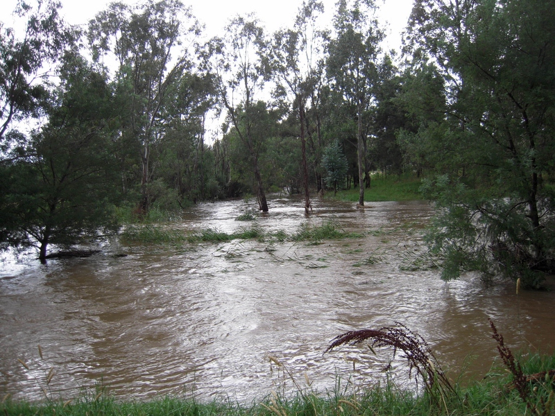
Forest Creek/Barkers Creek junction, January 2011: at the high point of the floods water coming into the streams was five times the carrying capacity of the stream beds.


There was an expectation that this would be a fiery meeting because of dissatisfaction with the way flooding has been handled: and it was clear from this meeting that there’s still plenty of anger and pain in the community about the issue, some of those affected by floodwaters  calling for extensive clearing of vegetation along Barkers and Campbells Creeks. It’s also clear that there’s a bit of confusion in the community about who exactly is responsible for our waterways, and it’s to be hoped this can be cleared up in this process.

The main thrust of the meeting, however, was to take and assess as many ideas as possible to prevent a repeat of the damage inflicted by the floods of 2011 and 2012. Among the ideas fielded were:

  • Essential services protection: the Castlemaine water treatment plant being a prime example. Flooding of this plant caused significant downstream pollution and some potentially serious health issues.
  • Vegetation along creeks: there are still calls for wholesale clearance, on the assumption that ‘the flood wouldn’t have damaged houses if all those trees hadn’t been there.’ This belief is quite false [see our posts here and here]. One group in 2011 even called for the clearing of ‘all trees growing below that which would be considered the high water mark.’ This would involve demolishing about a quarter of the Botanical gardens and turning the creek system into a gigantic ditch. Nevertheless it’s clear that some management of vegetation [particularly of willows, which raise the stream bed] is justified.

Continue reading

Posted in News | Comments Off on Flood management plan on the way?

Rethinking rural land use

The Mount Alexander Shire is conducting a Rural Land Study in order to establish how rural land in the Shire should be zoned. Current zoning of rural areas derives from a 2004 State Government planning decision designed in part to protect farming land from alienation by unproductive development. The resultant system is now under attack as insensitive to local needs, and the rural land study is an effort to see how land in the shire can best be used for a variety of potentially conflicting purposes.

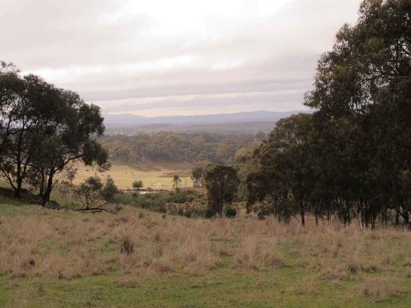
Agricultural land, Sandon: the rural land study aims to see how best to zone land for many distinct and sometimes conflicting values: production, scenery, biodiversity, heritage, tourism and residential development.

Information sessions on the study will be held as follows:

Thursday 14 March 2013
Baringhup Hall – 11:00am – 1:00pm Burke Street Baringhup
Metcalfe Hall – 4:00pm – 6:00pm Metcalfe-Kyneton Road, Metcalfe

Wednesday 20 March 2013
Muckleford Community Centre – 11:00pm – 1:00pm Walmer Road, Muckleford
Newstead Community Centre – 4:00pm – 6:00pm Lyons Street, Newstead

An issues paper prepared for council has listed some of the things that might come up in preparation of the study. Here are a few:

Continue reading

Posted in News | Comments Off on Rethinking rural land use

Where’s the heritage?

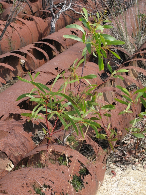
The photo below shows old sluicing pipes in the Fryers Forest. As they decay, they provide shelter for the growth of seedlings which will eventually hasten their destruction.

Is this decay the gradual fading of our heritage? Maybe–if we identify ‘heritage’ with old objects.

Nature reclaims the sluicing pipes, Fryers Forest: the regenerating bush is part of our heritage. Photo: Margaret Hogg


The Heritage Action Plan for the Castlemaine Diggings National Heritage Park says:

‘The current forest setting is…an interpretive bonus for the Park.  It highlights the transience of mining, demonstrates the severe environmental impact that can result from inadequate environmental constraint, and illustrates some of the resilience of Australia’s native vegetation.’ (page 29)

Continue reading

Posted in Nature Observations | 2 Comments

Ant behaving strangely

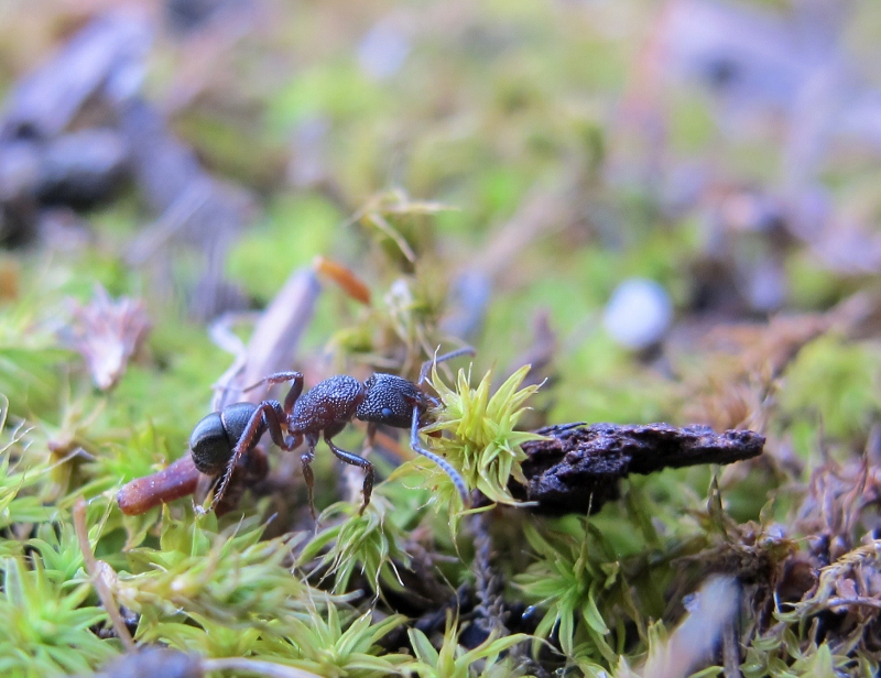
The ant pictured below is a member of the genus Rhytidoponera. The curious thing about it is that the creature is labouring to carry a shoot of moss [Pseudocrossidium crinitum].

Ant behaving strangely, Kalimna Park, February 2013


As far as we know, ants feed on other invertebrates and forage for such matter as honey. Moss somehow doesn’t fit the bill. The specimen above lugged its burden over difficult terrain for about a metre, then abandoned it. Any clues about this behaviour are welcome.

Posted in News | 1 Comment

Kalimna: weeds, fuel, fire

FOBIF has produced a weed map of the south western corner of Kalimna Park. This section of about 24 ha—essentially  the area from Kalimna Point to the golf course— is currently scheduled as a DSE Zone 1 asset protection burn [CAS 003], possibly this Autumn. We’ve been advised that DSE plans to treat the area closest to the town [heavily infested by gorse] by slashing.

The weed maps can be seen in our Documents section.

From our point of view, one of the interesting results of the survey is the confirmation that the areas along the Kalimna tourist road, and north east of the town water tank, are relatively weed free—as well as being floristically very interesting. DSE officers have been sympathetic to representations from residents concerned about the special qualities of this area.

The southern section of the block has a colony of Eltham Copper butterflies.

Section of Kalimna Park in the CAS 003 burn area. DSE is proposing to slash the section closest to the town.


FOBIF accepts that there’s a fuel management challenge in the Park, because of its proximity to the town boundary at Fletcher Street.  The area of CAS 003 is small by the standards of DSE burns: but it may be that the challenge would best be met [from the point of view of reducing fuel while getting a good ecological result] by breaking the parcel into even smaller sections, and treating each according to its particular qualities.

Continue reading

Posted in Fire Management, News | Comments Off on Kalimna: weeds, fuel, fire

Ever wonder where the soil went?

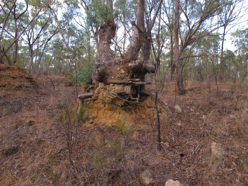
The photo below could be duplicated hundreds of times through our region: a tree sitting on a ‘pedestal’on the edge of a deeply eroded gully. When that tree was young, it was at ground level. So, where has all the soil gone?

Tree 'pedestal', German Gully: once this tree stood at ground level. Annual soil loss in most of Australia is estimated at one tonne per hectare, twice the rate at which it can be replaced by organic decomposition.


The obvious answer is, it’s been washed away downstream, eventually ending up in the Loddon, as a result first of nineteenth century mining works, and afterwards of a long process of erosion.  Here’s a report from the Mount Alexander Mail, August 27 1854:

‘The water in the Loddon was higher last week than it has been all the season. The puddling and sluicing on the banks of the stream have converted its once clear current into as muddy a state as many of its tributaries. It is said that the fish that were occasionally washed down Fryers Creek sunk to the bottom, as though suddenly deprived of motion, on reaching the earth-laden waters of the Loddon. Just now it is questionable whether any of the finny tribe can be found near the Junction.’

Almost all of our eroded gullies show a dual process: relentless erosion, and painfully slow build up of vegetation cover counteracting that erosion. In theory, land management policy encourages the second process to stop the first.

Continue reading

Posted in News | Comments Off on Ever wonder where the soil went?