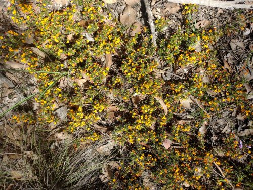
Mount Alexander Shire Biodiversity Strategy – A Critical Opportunity

Friends of Box Ironbark Forests has joined with Connecting Country and the Castlemaine Field Naturalists Club to prepare a joint submission on the development of the Mount Alexander Shire Biodiversity Strategy. You can view the submission here.

We prepared this submission because, after attending the community consultation sessions, it became clear that the proposed scope of the Biodiversity Strategy was far too narrow. The strategy was presented as focusing primarily on land directly managed by Council—particularly Council reserves and roadsides—rather than providing a comprehensive, municipality-wide vision for conserving biodiversity. We believe this would be a major missed opportunity. Our submission calls for a strategy that recognises the significant influence Council has through planning, policy, advocacy and partnerships, and sets out a bold, evidence-based framework for protecting and restoring biodiversity across the entire Shire.

Following our submission, we requested a meeting with Council to discuss these issues. Council declined, advising there was insufficient time before the draft strategy was prepared. While Council confirmed that our submission had been forwarded to the consultants and acknowledged that many of the issues raised had already been discussed internally, it gave no indication that our recommendations would be incorporated into the strategy.

We are disappointed by this response. Mount Alexander Shire has some of the most significant biodiversity values in Victoria, yet they continue to decline. This strategy is a once-in-a-generation opportunity to set a bold vision and clear direction for biodiversity conservation across the municipality. We are concerned that, unless Council is prepared to embrace meaningful reform, that opportunity risks being lost.

We encourage members to read our submission and, if you share these concerns, contact your local councillors and Council now. It is important they hear that the community expects a biodiversity strategy that is ambitious, comprehensive and capable of making a real difference—not simply a document that describes the status quo.

Posted in News | Leave a comment

Granite landscapes – by Christine Henderson

Granite landscapes are characterised by open, rolling country, often with boulders or smooth slabs of rock exposed on hillsides and in paddocks. The soil is deeper, sandier than on Basement rock country and provides good grazing farmland, as well as excellent soils for orchards and vineyards (as discussed in an earlier post on 22nd March 2026 Basement sandstones and mudstones were formed from eroded rock materials being carried by rivers then washed into the ocean and are known as sedimentary rocks).http://Field Guide development: The Geology of the Mount Alexander Region

Vineyard in granite country. Faraday-Sutton Grange Road

Granite grazing country with red gums. Metcalfe

Some of the most beautiful landscapes in the area are on granite country. Being predominantly grazing land, the old trees have been left in the paddocks, rather than removed as on cropping country.

The most prominent granite feature of the area is Leanganook – Mount Alexander itself, which rises to 745 metres altitude, some 350 metres above the surrounding area.

Leanganook/Mount Alexander from south of Taradale

Excursion 1. A short walk in Castlemaine CBD

An easy way to become familiar with the local granite rock is to examine the street drains and masonry of major buildings in the town. A short walk along Lyttleton Street, perhaps returning from a sojourn at the Anticlinal Fold, provides some fine examples of how masons and street builders have made good use of this attractive, durable building stone.

Street drain, Hargraves St. seen from Lyttleton St intersection

Court House gatepost, Lyttleton Street

With its pale grey, specked appearance the granite is evidently very different from the Basement sandstones and mudstones. Its hardness and lack of layering or structural weakness is shown off in the master craftsmanship of the courthouse gateposts

Next door to the courthouse is another historic building completed in 1890 to house Castlemaine’s School of Mines. It became the Technical School in 1926. Today it serves as the Mount Alexander Shire Council offices. While the building itself is constructed of Basement sandstone blocks, a plaque on the front wall is made of polished granite.

Plaque on Civic Centre, previously the School of Mines

Polished rock surfaces are prized items to geologists as they allow detailed examination of the rock constituents and fine-scale structure.

Granite plaque close-up

Looking closely we see three different constituents, coloured white, black and watery grey, which geologists call minerals. The white mineral is feldspar, the black is biotite (black mica) and the grey is quartz, a form of silica.  How do these minerals come to be in the rock, welded together? The answer lies in the nature of granite.

(At this point it should be noted that the geologically accurate name for this handsome rock is granodiorite, rather than granite, due to its lack of pink feldspar.  Granite is commonly used as a less cumbersome name.)

Granite is an igneous rock, which means it began as molten or liquid material. A huge mass of earth’s crustal material melted deep below the surface and gradually rose, making its way into the Basement rocks and forming an enormous reservoir of molten rock, known as a batholith.

The molten material, called magma, cooled slowly and solidified into rock several kilometres underground. The slow cooling led to the formation of the large mineral crystals visible to the naked eye.

Geologists believe that at least four kilometres thickness of rock has been eroded to expose the granite country we see today. Radiometric dating techniques, using naturally occurring radioactive elements in the mica and feldspar, show that the granite formed about 368 million years ago.

The question might be asked: where has all that material gone? Just as the material for the Basement rocks, sand and mud, came from the erosion of a mountain range, so this granite and its Basement rock cap have been eroded by the long action of water, ice and wind, breaking the sandstone and mudstone back into sand grains, mud particles. Eventually the granite too was worn down, quartz crystals broken into tiny sand grains and feldspar and mica crystals chemically changed to clay minerals, mud particles. All this material has been carried away by rivers and eventually deposited onto an ocean floor.

A quick calculation shows that the average rate of erosion is about a millimetre every hundred years. Less than half a metre of surface has been eroded in some 40,000 years of occupation by Dja Dja Wurrong people.

Extending our stroll around the Castlemaine streets shows us that granite has been, and continues to be employed widely in gutters, footpath features, bases of buildings, etc. Even the heritage-listed old Telegraph Office in Barker Street with its warm-toned Basement sandstone walls has a set of smart, if slightly jarring granite steps, presumably replacing the original, worn sandstone.

Old Telegraph Office, Barker Street, replete with granite steps

So where does all this granite come from? Not Castlemaine, which as we know lies on Basement rocks. The source is not far away.  To Be Continued…

Posted in Geology, News | Leave a comment

The Loddon Company Race, Irishtown walk, Sunday June 21


image by Chris Green

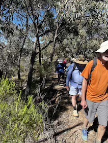
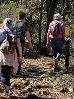
It’d been pretty wet leading up to Sunday for the scheduled FOBIF walk led by Steve Charman and, in retrospect, the conditions undoubtedly made the 5km walk a little
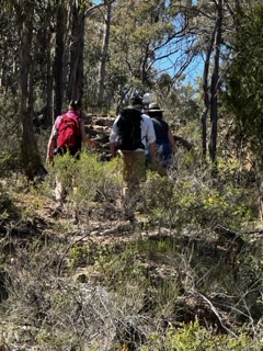
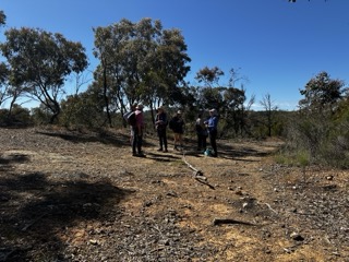
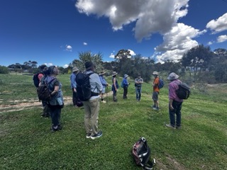
more challenging than intended. Around 10am, a party of about 12 walkers set out from an old road reservation near the corner of the Vaughan-Chewton Road and the Drummond-Vaughan Rd to do a circuit, first following the Loddon Company Race upstream to a point near Devil Track and then crossing over to the Fryers Race to follow it downstream back to the carpark.

The slippery nature of the moss covered banks of both races made it necessary for the walkers to gingerly test each step and some of the party decided half way through the walk to call it a day and return along Irishtown Track to their cars. The remainder, with some trepidation, decided to plough on, picking their way back along the Fryers-Vaughan Race perched high on a steep hillside. Golf spikes would have come in handy!

A major highlight was a visit to the remarkable Devil’s Gully Tunnel through which water from the Coliban system and the Loddon River once flowed in opposite directions, Coliban water heading south to Vaughan and Loddon River water flowing north to the Red Hill area. At the same time! The achievement of the workers who designed and cut these long water races was much in evidence.

There was a range of beautiful fungi fruiting bodies on display. Joy Walker, co-author of Fungi of the Bendigo Region, was not on the walk this month but kindly identified the fungi from these images. 

Huge thanks to Steve Charman for not only leading the walk, but for providing the text for this report as well. 

Posted in Walks | 1 Comment

Harry Nankin’s Acts of Ritual, 2020-24

A beautiful profile from Harry Nankin, published in-

News & views about Australian large format camera users and darkroom photographers
 
Harry Nankin’s Acts of Ritual, 2020-24

I live near the bottom of a shallow squiggle of the Great Dividing Range, in the watershed of a fast little branch of the Loddon, which is a big tributary of the much bigger, muddy, winding, Murray. It’s a broad, elevated, water-corrugated sandstone basin punctuated by volcanic cones and granite rises, one of which, Mount Alexander (or Leanganook in the language of its original Indigenous owners, the Dja Dja Wurrung clans), is the district’s administrative namesake. Once, not that long ago really, much of the region was inhabited by sclerophyll forests canopied by widely-spaced, broad-girthed, old red gums, yellow gum, grey box, long-leaf box and red ironbarks and floored by an exceptionally biodiverse understory of herbs, bushes, grasses and orchids. In the 1830’s white squatters began to steal the flats and valleys from the Dja Dja Wurrung for livestock grazing. For the Aborigines, it was a calamity. Decimated by European diseases and deprived of sustenance, their resistance was met with mortal reprisal. Several documented massacres at known locations by armed settlers between 1838 and 1846 are the tip of a bloody iceberg the true scale of which will probably never be known. Then, in the middle of the century, tens of thousands of ravenous fossickers, many of them hardened panners from the California rush, severed the trees and disembowled what lay beneath, turning the auriferous earth ‘upside down’ trampling, burning, sluicing and spading for gold. The post rush-scape of bare ground, erosion gouged gullies, pock-holed hillsides, quartz-flecked muck heaps, spidery water races, earthen dams, rusty pipelines and crumbling pump houses nowadays appeals to frontier partisans and tourist sentiment. The residue of that ransacking has been enveloped by a slowly regenerating over-story of thin, multi-stemmed coppiced trees with sparse, often weedy, undergrowth, quite unlike the mature forests stably stewarded for tens of thousands of years by its First Peoples. Revived mining, residential subdivision, expanding infrastructure, an absence of traditional Indigenous fire-stick practices, dieback from cinnamon fungus, cup moth caterpillar infestation and, above all, climate change, threaten further recovery. 

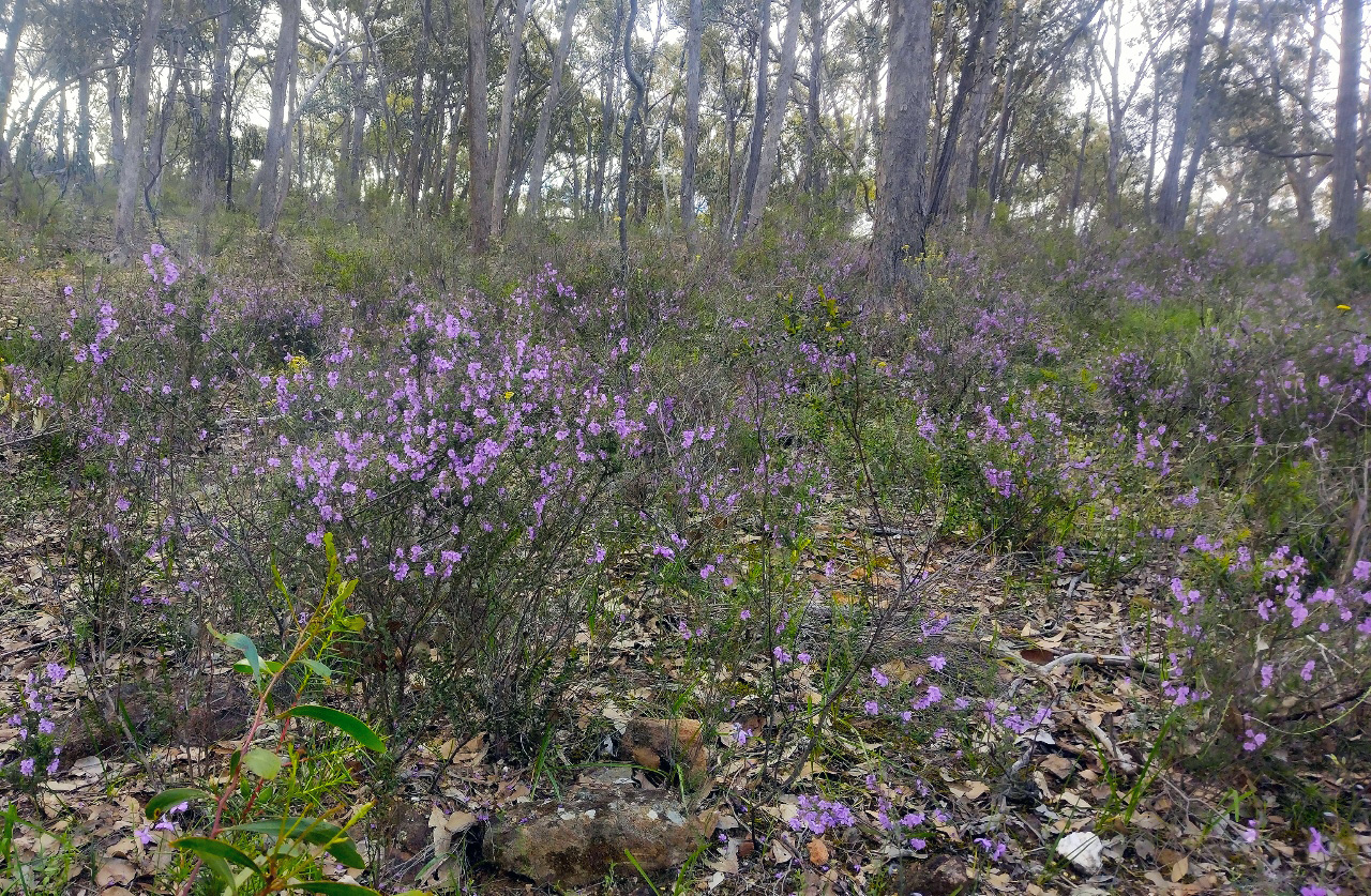
I do not find this unprepossessing, trampled country easy to be enthralled by, let alone, love. It’s not that I’m oblivious to its beauty. The big, open skies. Transparent blue, dry, for weeks, in the hot months. Fogs, frost, rain, churning, streaming cloud, in the cool. A hundred kilometres from the sea and a third up, when the sun sets, the temperature plummets. Nights, so dark and sparkling, you can often make out the dark emu. Although natural variability exacerbated by global heating renders any climate forecasting uncertain, for the time being at least it remains true that in winter, the namesake flowering of golden wattle, Australia’s floral emblem, brocades these forests. And, in spring, blue bunonia, purple chocolate lilies,yellow billy buttons, yam daisies (or murnong, once an Indigenous staple), and white, pink and red common heath (Epacris), pigment the understory. Without a map or GPS, you can rough your whereabouts triangulating by eye the familiar, comforting, blue, wooded prominences of Leanganook and Tarangower, the volcanic crater of Langambrook (Mount Franklin), rumpled Fryers Ridge, and, if you have far views, the granite-torred ‘mountain of light’ Guyura (Mount Kooyoora), fabled, crenelated Ngannelong (Hanging Rock) and the sylvan, kilometre-high saddleback of Geboor (Mount Macedon).

Many of those who already do or wish to love this region are working assiduously to conserve and reprise the landscape and its ecology, with some success. Of course, nobody can bring back the carpet of mature forests or the legion of extinct species or completely disappear the weeds and feral cats, foxes and bunnies or right the quarried upside-down soil profile. It’s protecting and understanding what remains that matters: the surviving grand old trees, the recuperating woodlands and their complement of rare, threatened and endangered creatures whose multi-consonant settler common names, listed spoken, tangle the tongue. Eltham copper butterfly. Brush-tailed phascogale. Fat-tailed dunnart. Woodland blind snake. Eastern bearded dragon. Many-lined delma. Lace monitor. Growling grass frog. Brown toadlet. Southern bell frog. Powerful owl. Barking owl. Black-chinned honeyeater. Brown treecreeper. Swift parrot. Diamond firetail. 

I am not alone in wishing the region’s bushland, creek lines, hilltops and ridges could be returned to something like they were under indigenous care, before the squatters and the gold rushes. But achieving that might be as counterproductive as it is improbable. Yellow-tailed black cockatoos are an infrequent delight as they call overhead, feed on the seeds of planted and invasive monterey pines instead of the banksias and other natives removed to make way for plantations of the American tree, as well as mines, farms and towns. Regrowing banksias on disturbed ground is problematic and the yellow tails would almost certainly perish without the pines. There is a scattering of miners and farmers dams across this landscape. One of the biggest, earth barraged Expedition Pass reservoir constructed during the gold rushes diverted and drowned once-wooded Forest Creek valley. Artificial it may be but, in an increasingly irritable climate, this impoundment, like others, offers reliable habitat for sedges, rushes and reeds, reed warblers, welcome swallows, frogs, dragonflies, ducks and a treasured, safe, swimming hole for locals, who affectionately dub it, The Res. 

Road and railway cuttings dissect this hilly country. Some are spectacles. Along the boundary of the Castlemaine Diggings Heritage Park near where I live there’s a hundred-metre-long, three-metre-high corridor of vehicular cut-through. Walking it, you passage through a Neapolitan mineral extravaganza millions of years long. Plump band upon thin layer upon tendril stripe of sandstone, slate and mudstone in differing, alternating hues of blue-grey, deep purple, olive, grey-white, yellow and jet-black, spotted with blobs of tan, the bulk tilted 70 degrees from the horizontal, intercepted here and there, with perpendicular fractures and shelves. The laminations are Lower Ordovician sediments, laid down 487 to 475 million years ago into a shallow Gondwanan seacoast eroded from a vast mountain range to the west. The sediments were hardened to stone by time, heat and pressure before arising, folded and twisted oblique by colliding continents. The early Ordovician was an era of greenhouse swelter, molluscs, cephalopods and graptolites, way predating dinosaurs, trees or Australia. Scout the excavated tops, and look down to the ground, you notice the parallel rills of eroded lamination, like most of the local geological faults, align precisely north-south. A stratigraphic compass. Here, to speed machine locomotion, primeval oceans and deep time have, unwittingly, been scraped into view, haunting the seams we step on and the veins we touch.

I returned to the craft of slow lens photography in 2020 using a pre-loved ‘5×7 inch’ Deardorff wooden field camera, during the pandemic, primarily to try to learn to love this country. I endeavoured to approach each photographic act as if it was a ritual, devoted to glimpsing the light of presence imminent within, behind and beyond the shadows. The archaic optical and photochemical technologies I employ are analogous to those in use before Djandak’s trees were felled, its rind was mutilated and its custodians banished, but of which no photographs are known to exist. They report a wounded landscape in which distinguishing what is natural from what is not is confounded. My images of Leanganook are already memorial: in January 2026, a bushfire wiped away most of its regrown one-and-a-half-century-old forest. In being granted these pictures, my recurring question was (and remains still) if and how I (or anyone) can experience this country as precious, beautiful or indeed, sacred, without ignoring, ennobling or wishing-away its injuries, incursions and absences.

Acts of Ritual 2, Poverty Gully, 2020
Post-processed scan of a 5 x 7 (12.7 x 17.7 cm) gelatin silver negative.
Acts of Ritual 13, Poverty Gully, 2020.
Post-processed scan of a 5 x 7 (12.7 x 17.7 cm) gelatin silver negative.
Acts of Ritual 14, Mount Leanganook, 2020
Post-processed scan of a 5 x 7 (12.7 x 17.7 cm) gelatin silver negative.
Acts of Ritual 23, Expedition Pass Reservoir, 2020.
Post-processed scan of a 5 x 7 (12.7 x 17.7 cm) gelatin silver negative.
Acts of Ritual 30, Mount Leanganook, 2020
Post-processed scan of a 5 x 7 (12.7 x 17.7 cm) gelatin silver negative.
Acts of Ritual 32, Expedition Pass Reservoir, 2020
Post-processed scan of a 5 x 7 (12.7 x 17.7 cm) gelatin silver negative.
Acts of Ritual 33, Poverty Gully, 2021
Post-processed scan of a 5 x 7 (12.7 x 17.7 cm) gelatin silver negative.
Acts of Ritual 38, Expedition Pass Reservoir, 2023
Post-processed scan of a 5 x 7 (12.7 x 17.7 cm) gelatin silver negative.
Acts of Ritual 48, Vaughan Springs, 2024
Post-processed scan of a 5 x 7 (12.7 x 17.7 cm) gelatin silver negative.
Acts of Ritual 51, Poverty Gully, 2024
Post-processed scan of a 5 x 7 (12.7 x 17.7 cm) gelatin silver negative.
Acts of Ritual 57, Fryers Ridge, 2024
Post-processed scan of a 5 x 7 (12.7 x 17.7 cm) gelatin silver negative.
Acts of Ritual 58, Fryers Ridge, 2024
Post-processed scan of a 5 x 7 (12.7 x 17.7 cm) gelatin silver negative.
This article was written by

Harry Nankin is a fine art photographer & author based in Castlemaine, Victoria.

Posted in News | Leave a comment

Four Corners on native forest logging in Victoria

Posted in News | Leave a comment