Last week FOBIF secretary Bernard Slattery wrote to DSE Bendigo to express our concerns about Tarilta Gorge, in particular the massive soil loss resulting from the Department’s management burn [see our post].We’ve received the following answers to our questions from Paul Bates,Forest Manager, Bendigo Forest Management Area. For convenience of readers, we’ve put our questions in italics before each answer. Readers can assess whether our questions have been answered:
1. Last year in our submission on fire zones we drew attention to the steep slopes in this area, and the need to be extra careful in any burning operation. Given that heavy rain was predicted in the week after the proposed burn, why was there evidently no effort to protect the steeper slopes? [Sludge in the creek is up to a metre deep in parts. In walking along the creek bed I went up to my waist at one point in soil and ash]
DSE: ‘DSE monitors fuel and weather conditions when completing prescribed burns. The weather records over the days when this burn was ignited show that the conditions were within the limits for burning in this type of forest. DSE also monitors weather forecasts for the days following ignition of a prescribed burn including potential rainfall. Predicting accurate rainfall amounts and intensity can be difficult, especially predictions several days ahead. All weather factors are considered and a decision was made in this particular case that ignition of the burn area would proceed.’

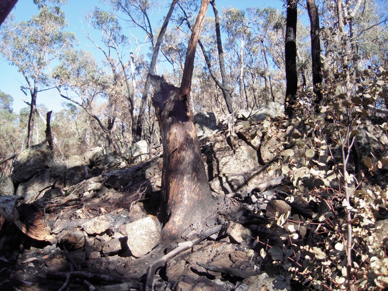
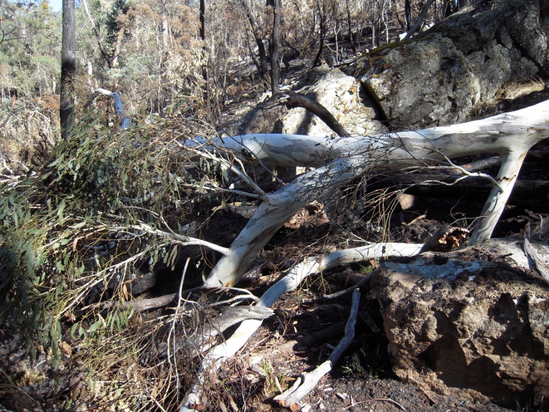
Destroyed candlebark, ten metres from Tarilta creek. We estimate that the tree was about a metre in diametre at breast height. Although it is hard to estimate its height, it may well have been the tallest tree in the valley [see additional photo below
2. We’re still at a loss as to DSE’s inability to protect large trees from these burns. Red box on the slopes and even larger trees on the valley floor have been destroyed. We’d like to know what kind of supervision takes place in this area.
DSE: The Murray Goldfields District puts a lot of effort into minimising damage to large old trees. DSE and PV field staff spent over a week raking around many large old trees in this burn area. With a burn area size of about 550ha, every attempt is made to locate and rake all large old trees however it can not be guaranteed that all such trees will be located. Protection of these trees is an important part of preparing areas for prescribed burning.
3. The Ecological Management Zone’s purpose is ‘promoting biodiversity and ecological renewal. Planned burning will be used to manage native species and ecological communities which require fire to regenerate.’ Can you tell us which species you had in mind in this operation? Is there baseline data to enable an assessment of the success of the operation?
DSE: ‘This burn is in the ecological management zone, zone 3. The EVC’s are present in the burn area, Heathy dry forest and Valley grassy forest. Apart from several small bush fires, the burn area has no known fire history. The ecological objective of the burn was to introduce fire into the long unburnt forest.’

Part of the top of the same tree. The repeated destruction of very large trees is an indicator of the bluntness of DSE methods.
4. We were under the impression that in this zone the intention is to do a mosaic burn covering about one third of the area. It seems to us that much more was actually burnt. Can you tell us what your estimate is of the burn coverage?
DSE: ‘I am not able to provide you with an estimate of burn coverage of the burn however DSE plans to undertake fire intensity and burn coverage mapping on this burn.’
FOBIF has sent the following follow up questions, which we can’t see answered in DSE’s response:
1. In the light of the weather forecast, why was there evidently no effort to prevent soil loss from the steep slopes of the gorge?
2. We repeat the second question: What kind of supervision takes place during the burn to prevent ecological damage, like the destruction of possibly the biggest tree in the valley?
3. We repeat the third question: What species did managers have in mind as potentially benefiting from this operation?
We’ll publish any response as soon as we get it.


 Click on image for info/order page
 Click on image for info/order page
 Click on image for info/order page


The only trees that were raked around were on the perimeter of the burn and after extensively walking the whole gorge area there is no evidence of any large trees being protected .
Having observed flows of both the Tarilta and Hunters creeks over a period of 35 years , the hunter creek always flows at least 3 to 4 days before the Tarilta creek because the Hunter flows through a lot of open farmland. The rain we had after the burn was about an inch,the hunter only just flowed whereas as can be seen in photos the Tarilta had enormous runoff which would never have happened if it was not burnt resulting in devastating erosion. One wonders how this is GOOD ecological management!
Every March we hear the powerful owl calling from the Tarilta Gorge area, but this year we haven’t heard a HOOT. This is the very top of the food chain and is a great indicator of ecological health. Approx 2 months ago we were lucky enough to photograph a pair of fledged powerfuls, let’s hope they return.
We hope that the people responsible for this burn will be man enough to face the people who love this most beautiful part of Australia and explain their actions . I would love to see the Minister walk this gorge to see the damage caused by this reckless act.
I am very interested in DSE’s response about mapping of the ‘fire intensity’ and ‘burn coverage’. The same issues are of concern in the Muckleford Forest – as those who came on the FOBIF walk recently can attest. And the eological objective seems empty of real purpose – why introduce burning – just because it is long unburnt? What is the fire history of this forest – pre 1788 and since?
And tree raking – in the Muckleford it was only along tracks. In many places we walked in off the track just 20 or 30 metres to large trees and found them unraked. And we found dead trees and stumps raked (perhaps for good habitat purposes) and trees with bridal creeper growing at the base also carefully raked – and the bridal creeper left intact (grrr). And of course the nature of past timber getting means many trees have hollows at their base – and these form a fireplace of extended burning – knocking down what are quite old trees. It really makes me mad!
It’s interesting to note that when we walked through only a week before the burn we didn’t see any raking around any of the old big trees. There was about half a dozen trees raked around along Limestone Track and a few along Porcupine Ridge Road. I would be very surprised if any DSE people actually walked down the creek in that week prior to the burn. We have a few more images on our latest blog: http://osp.com.au/?p=3278
Keep up the good work FOBIF. DSE should be accountable for their actions….and their statements too.